| PREVIOUS | NEXT | HOME | BACK TO BLOG |
Southwest Vacation
Part 3: Grand Canyon
(Note: Clicking on any image in this travelogue will bring up a full screen version of the image.)
Thursday, September 7
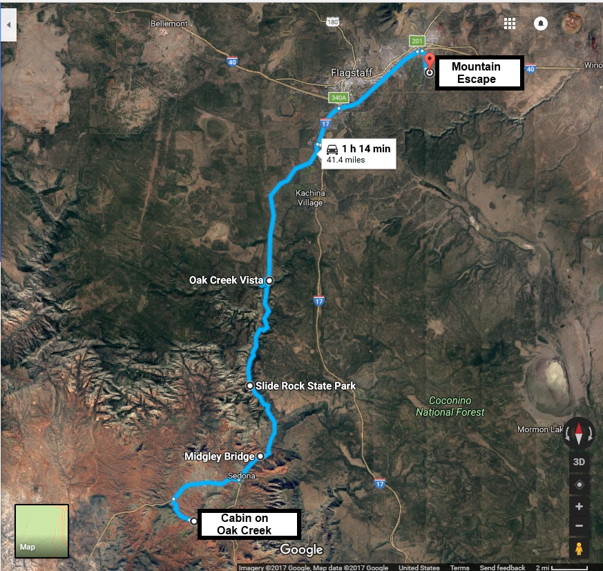
Sedona to Flagstaff
It was almost time to say good bye to our lovely Cabin on Oak Creek. But checkout time was 11:00, and we never actually had seen Oak Creek from the Cabin. So we decided to take a walk out to Crescent Moon Park on the Creek that our Host had recommended before we left.
Crescent Moon Park
|
|
|
|
|
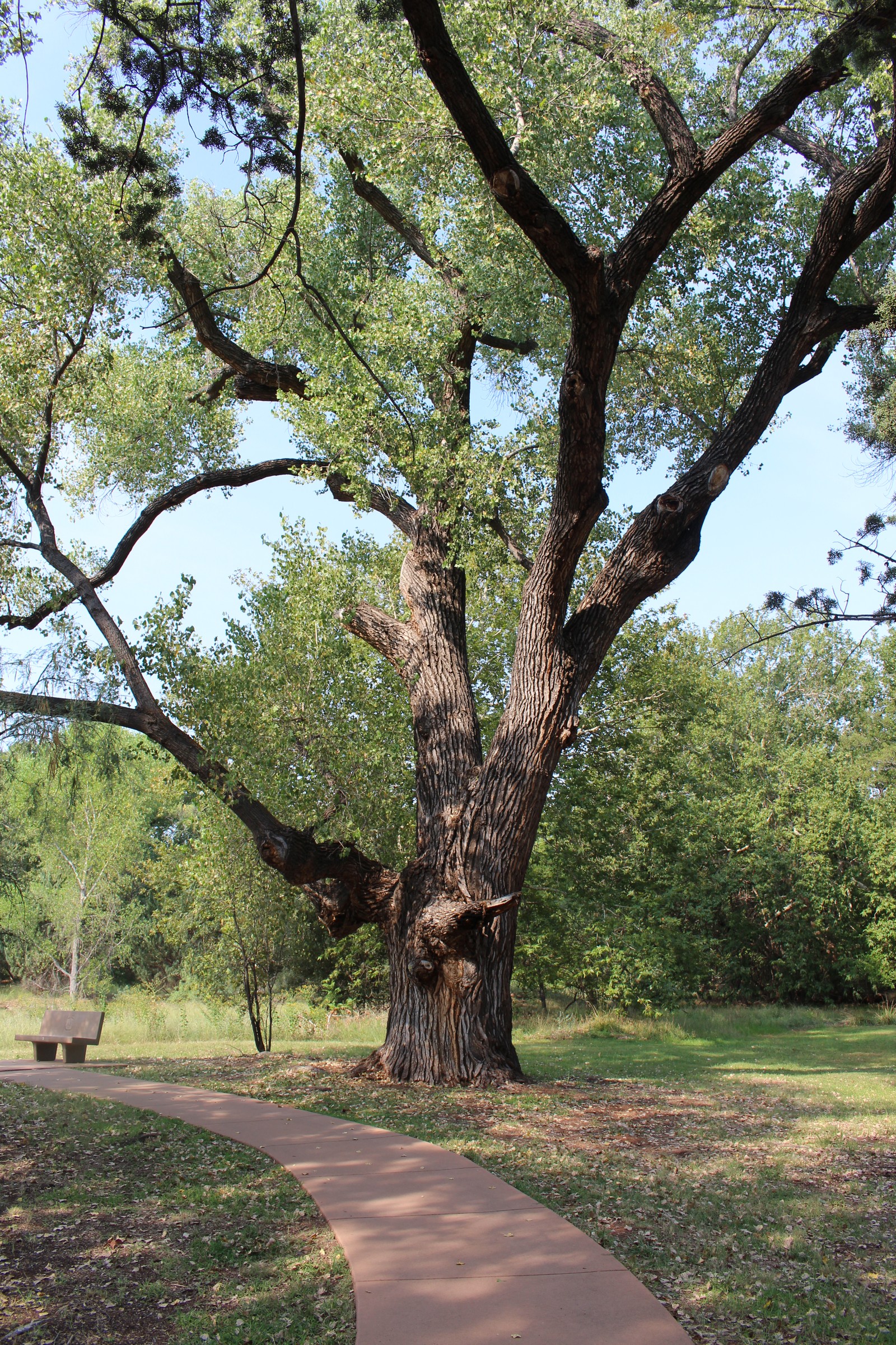
Well, if there was one minor flaw in our Cabin on Oak Creek, it might be in the area of Truth in Advertising. Actually waterway on which the cabin was situated was a mostly dry tributary of Oak Creek. So we followed the dry creek bed to a road, which led to the park, which was indeed on Oak Creek proper. It turned out there was an admission charge to the park. But we sweet-talked the attendant into letting us in for free, because we just wanted to take a peek at the place before we left, and we wouldn't be there for more than a half hour or 45 minutes or so. Situated right on the banks of the Creek, it was greener there than most places in Sedona. But still, the grass wasn't the lush sort we're used to back East. It was pretty devoid of people at this time of a Thursday morning, so we wandered about in idyllic solitude over its lovely grounds, and cooled our feet in the water. They were glad of the cooling, as even here by the water, the temperature was pushing into the 90s quite early in the day.
We passed our allotted time in companionable silence, and then headed back to the cabin via the road, rather than through the dry waddy by which we had come. We did our final packing and loading into the car, made sure everything in the Cabin was left as we found it, made our idiot check to be sure we had all our belongings, and headed out for Flagstaff.
Midgley Bridge
|
|
|
|
|
|
|
|
|
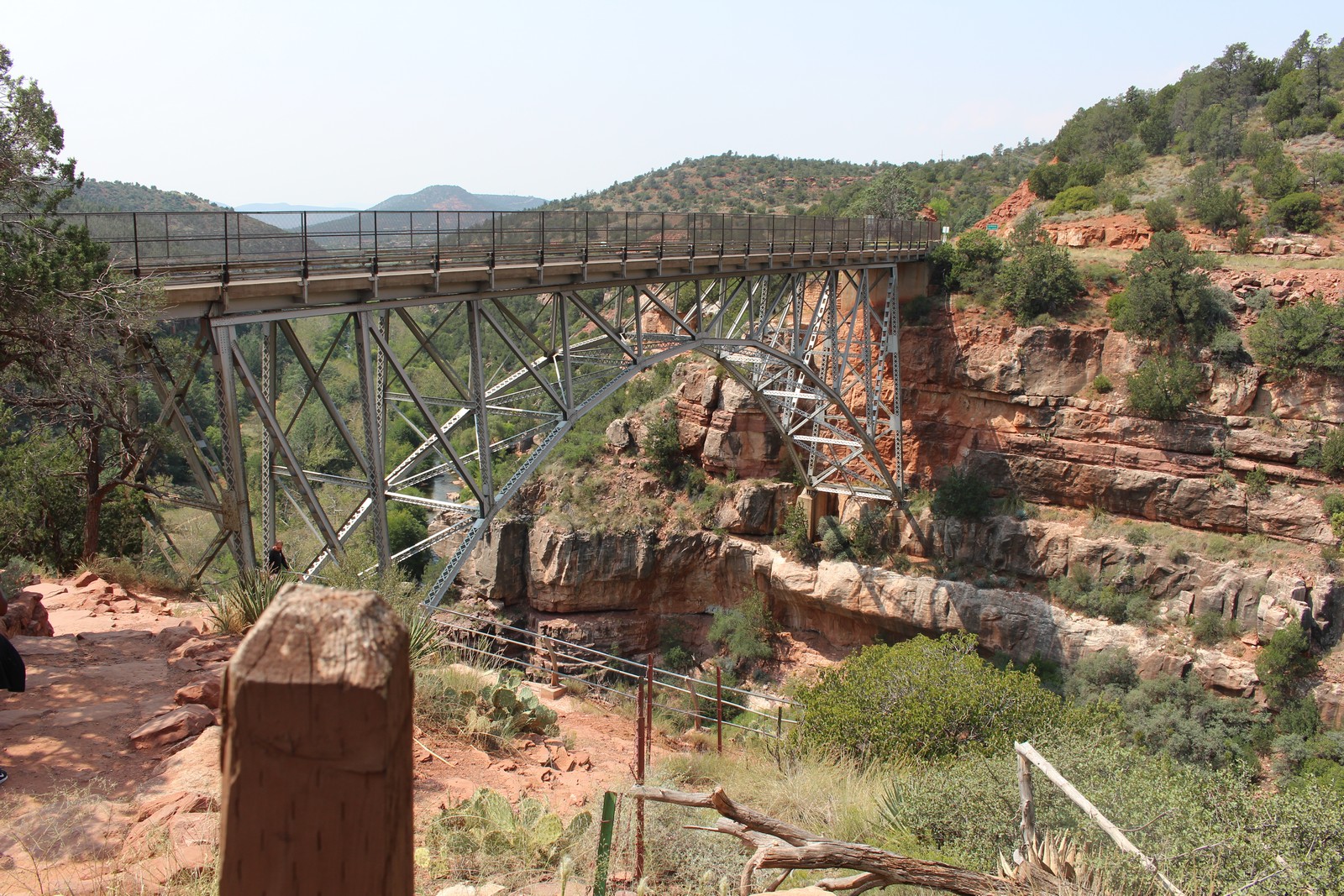
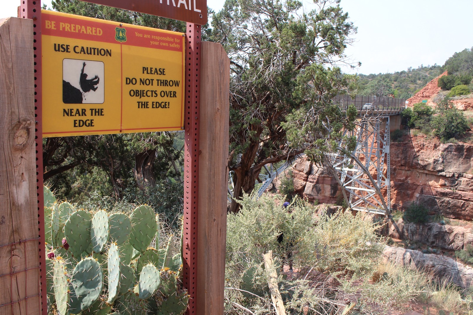
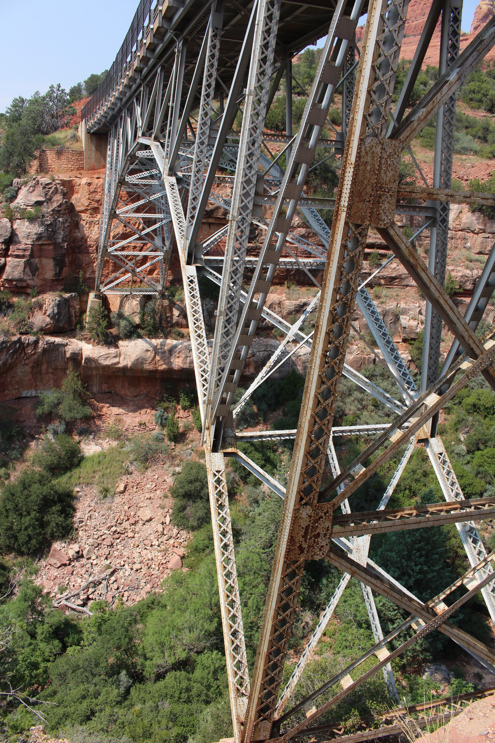
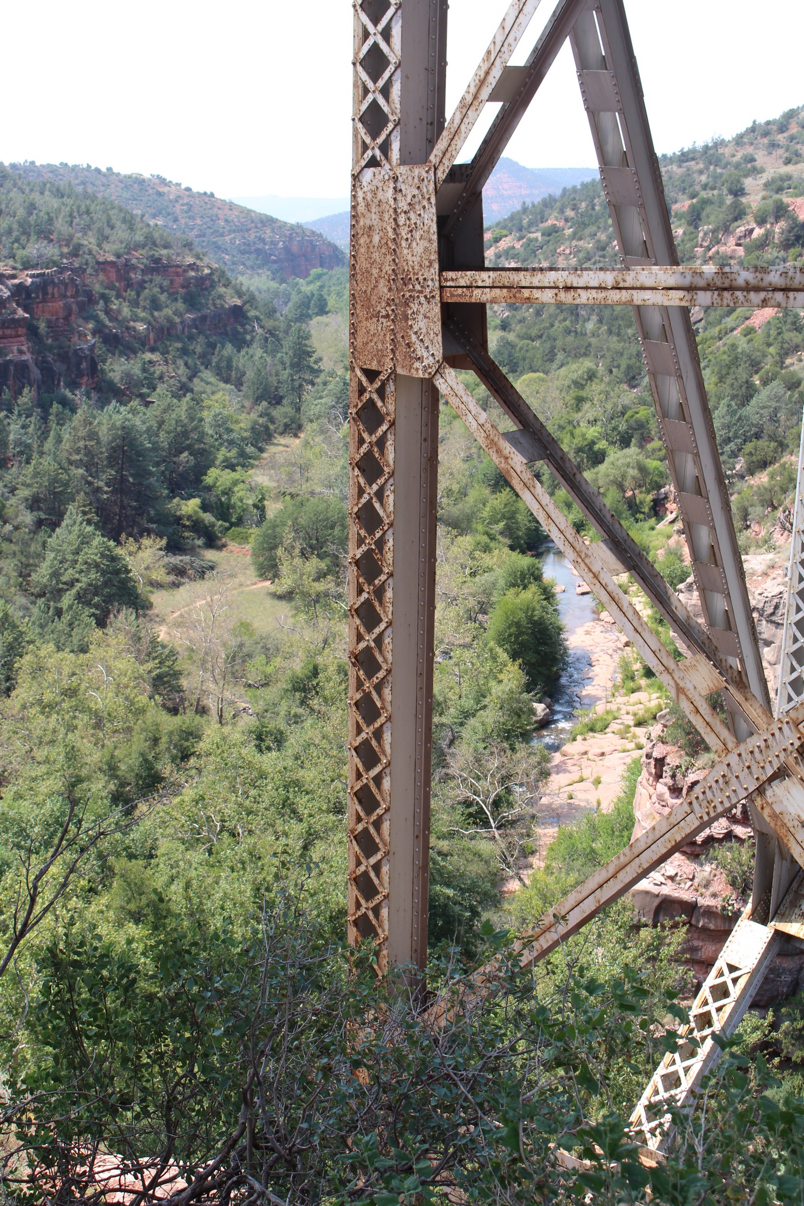
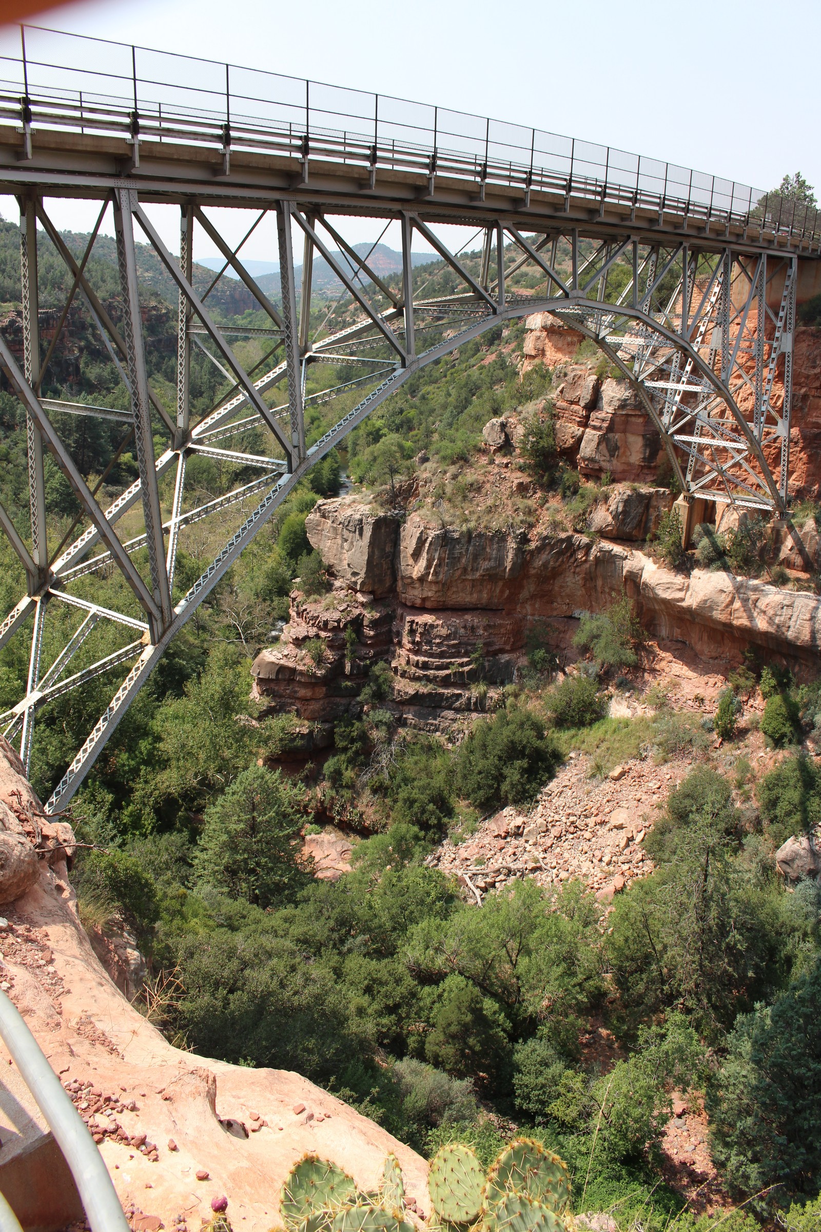
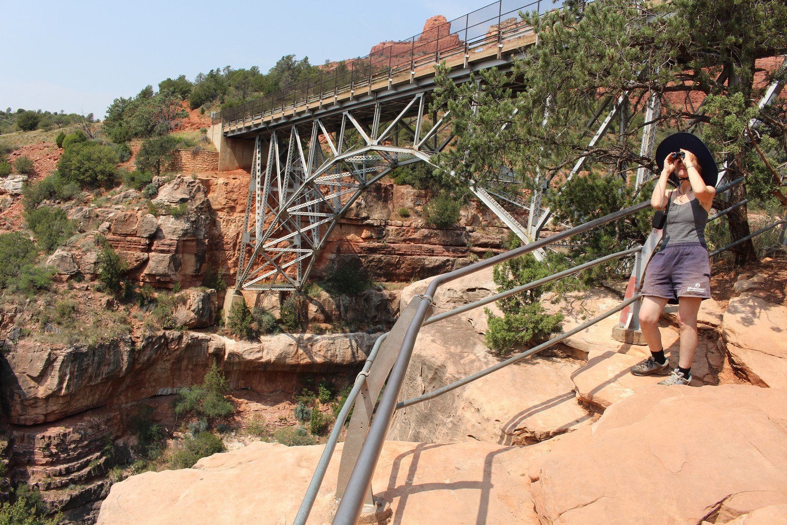
Flagstaff looked like a straight shot up Route 89A, the main drag of Sedona, until it picked up I-17 into Flagstaff. Well, 89A turned out to be a delightfully curvey shot, rather than straight. And only a few miles out of Sedona I was presented with the view of a magnificent arch bridge that leapt over Wilson Canyon. I am a sucker for picturesque bridges. And this one was a beaut. Built in the late 30s, it is the classic steel arch pared down to its bare minimum structural requirements, and beautiful in its simplicity. Built almost entirely from standard construction steel shapes with almost no specialized casting or forgings (The arch itself is constructed from a series of straight girders. No curves.), it looks like something built from a giant Erector Set. My engineer's eye could easily trace all the forces through each member from the deck on down to the anchorages on the cliff faces.
Apparently the State of Arizona saw the visual appeal of the bridge as well, and provided a parking area on the far side with crude paths where we could get out, and go down amidst the structure, and gaze up at the bridge or down into the canyon. The bridge is evidently somewhat behind in its maintenance schedule, as there is some mild rust appearing throughout the structure. I burned through a few gigabytes of photos of details that would be boring to most readers. It was hard for me to limit it to just these nine.
Slide Rock State Park
|
|
|
|
|
|
|
|
|
|
|
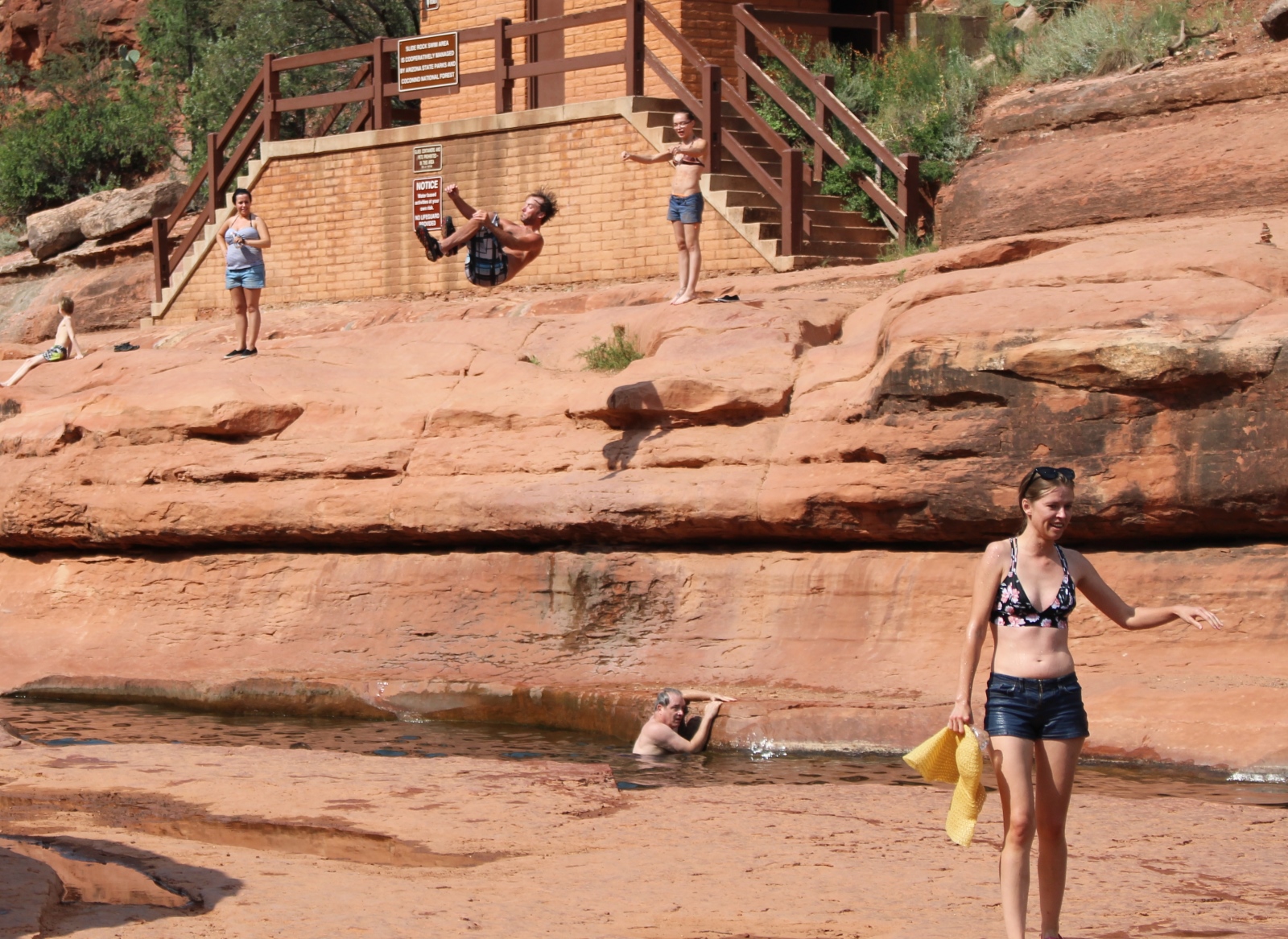
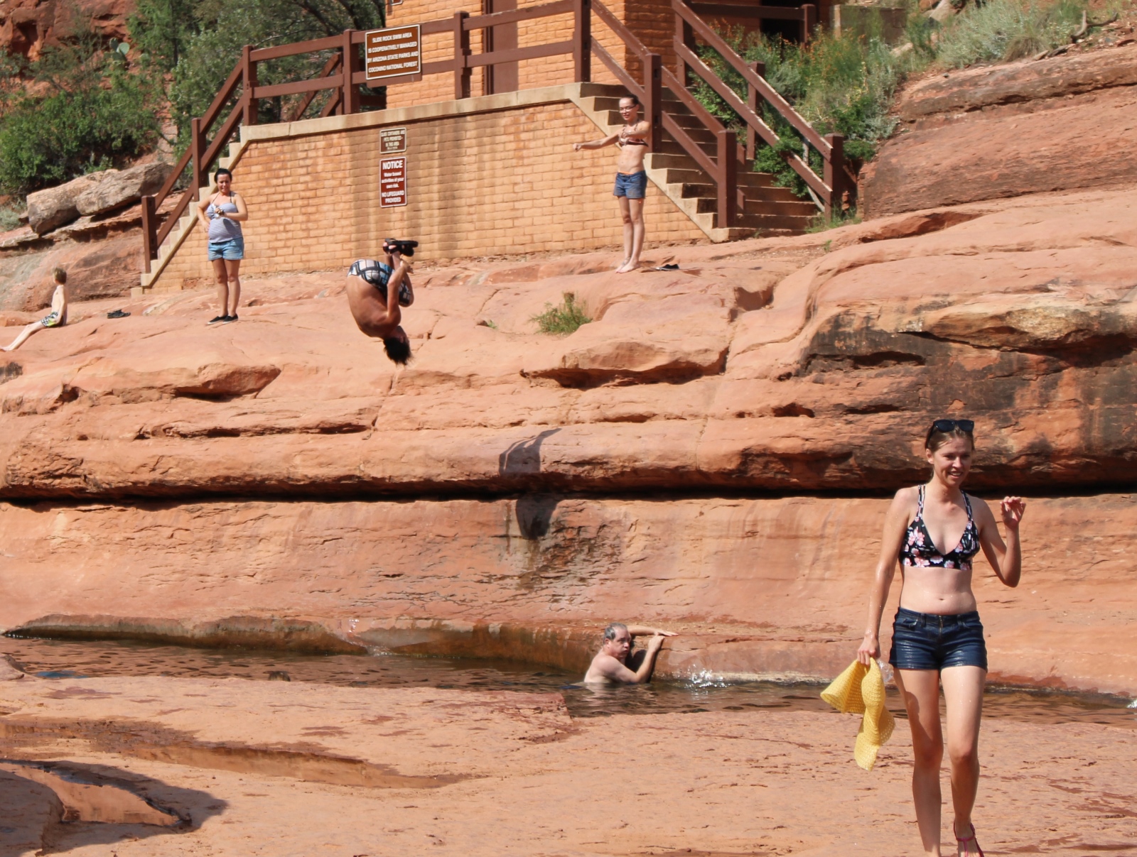
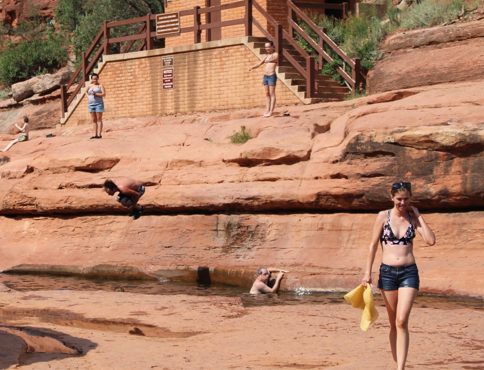
| 260. Intrepid high-diver | ||||
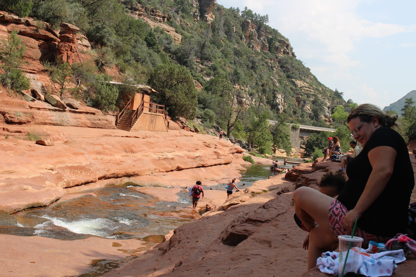
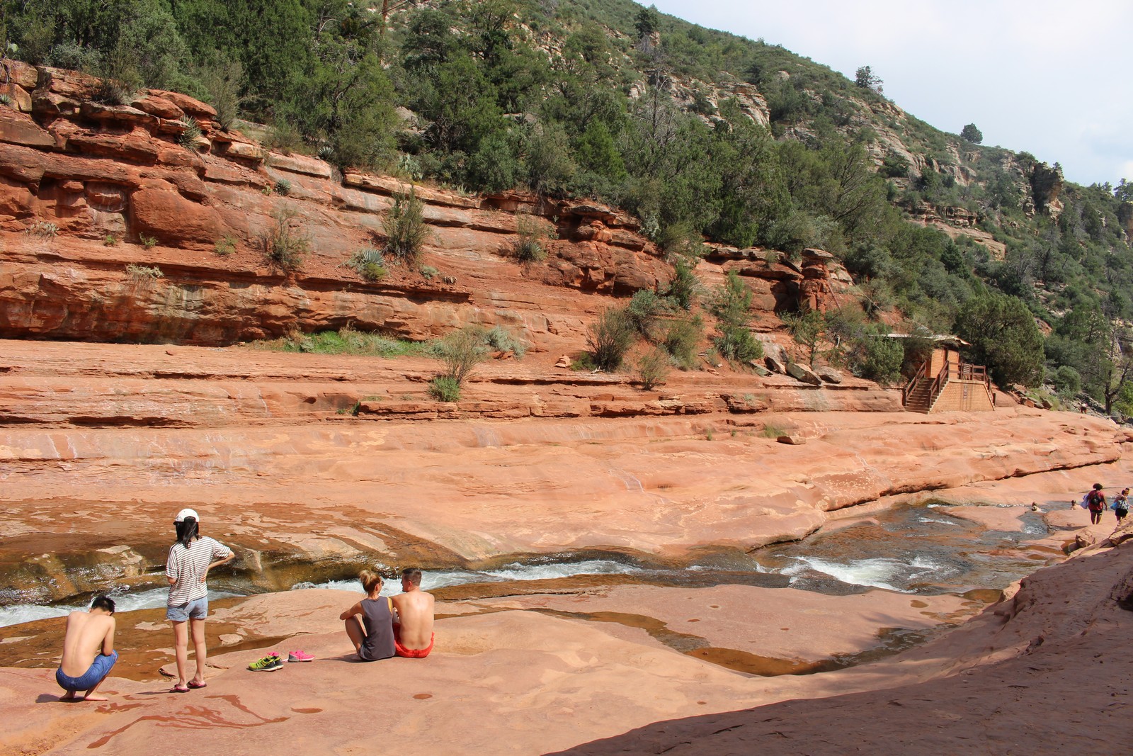
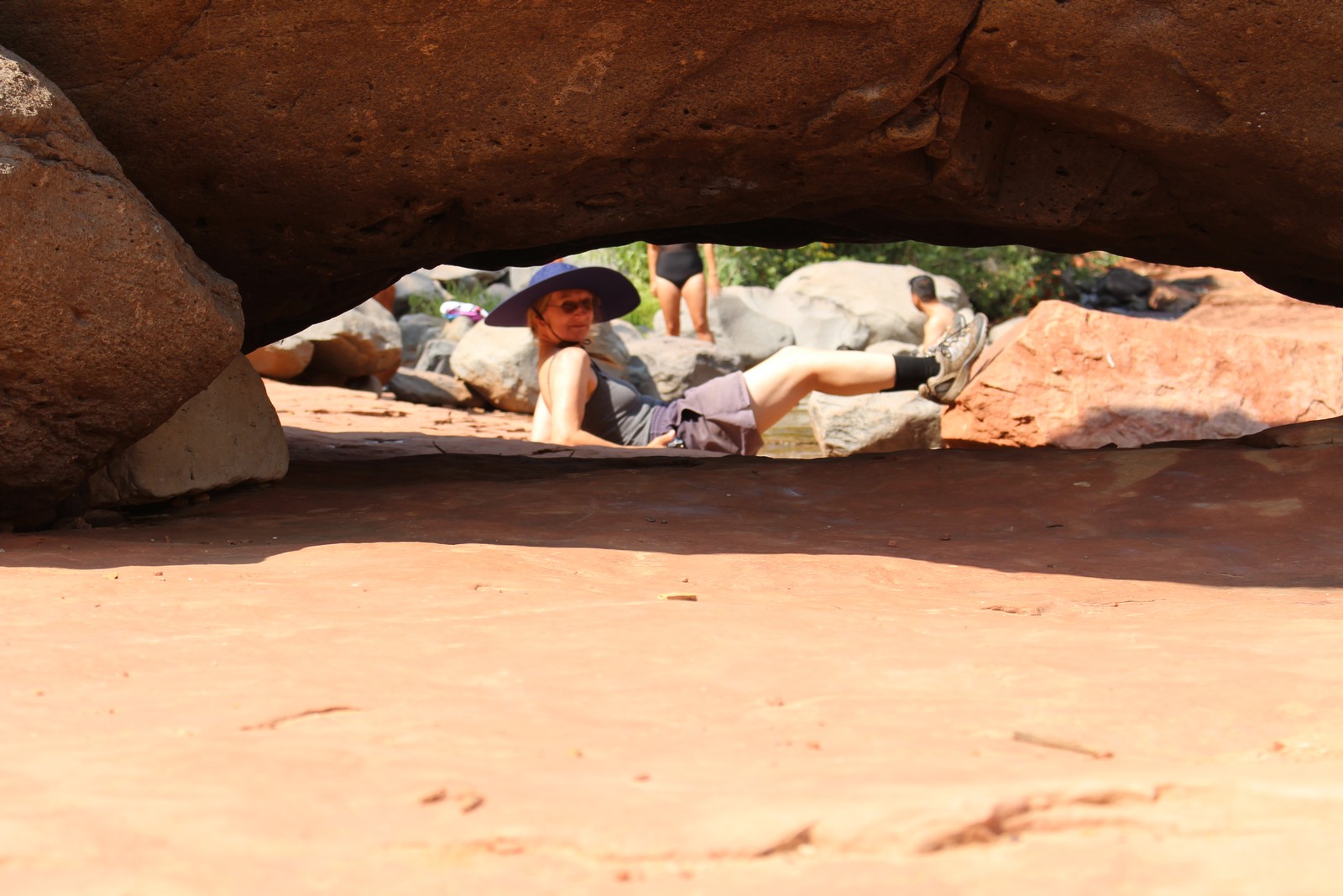
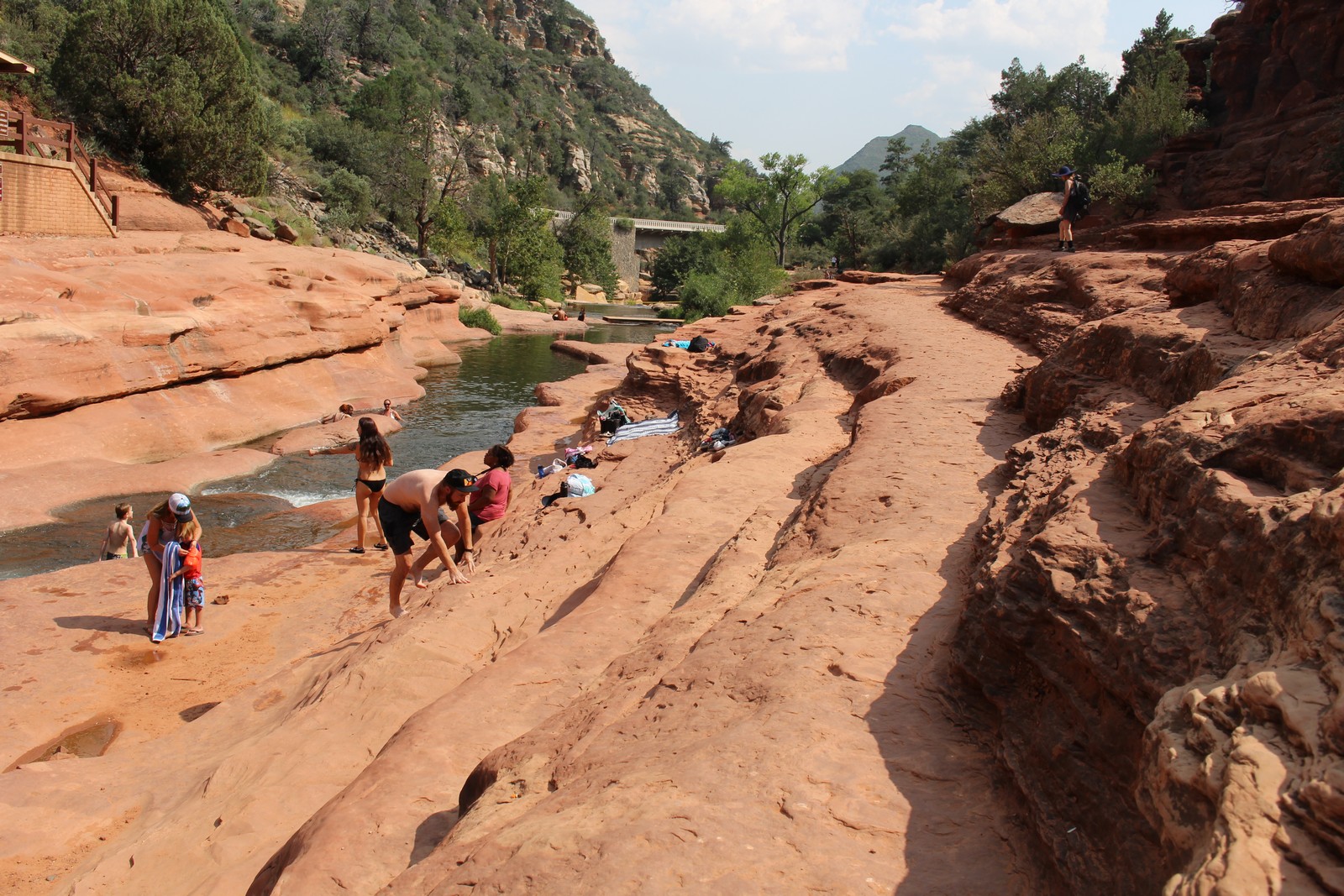
Route 89A is a beautiful 2-lane that follows Oak Creek through an impressively steep and high canyon. A few miles north of Midgley Bridge we stopped at Slide Rock State Park for some lunch and some thrills. Andrew had recommended it, and I was eager to experience it. It is an area where Oak Creek narrows to a small flume cut in the sandstone, whose walls have been worn smooth by the centuries of rushing water. And the size and current are perfect for a person to ride the flume for about 100 yards in comfort. The area was originally a private apple orchard, now incorporated into the park, and maintained by the park staff to provide fresh apples for the visitors (and themselves).
The staff were a young and jolly bunch, bantering with the visitors. I asked if I could leave my guitar somewhere safe in the Welcome Center so it wouldn't cook in the car, and they gladly promised to get a good price for it. We walked out to the picnic area, found a shady table, and polished off the last of our chicken and salad from Monday's dinner, supplemented by fresh apples. We realized too late that we had neglected to bring any utensils. But Jenny borrowed my pocket knife, and fashioned a couple of pairs of improvised chopsticks out of indigenous twigs. Thus fortified, we donned swimsuits, and walked down a short path to the creek and the natural water park.
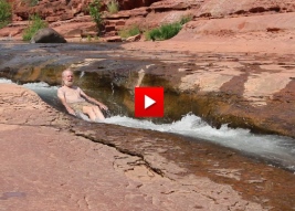
There is an area not far from my home near the Delaware Water Gap called Van Campen Glen that is sort of like a smaller version of this place. But the area you can slide down is much shorter, and unless it's been raining heavily recently, the current isn't nearly strong enough to propel you down the slide. But here, the conditions were perfect. Well almost perfect. The water was cold. But still it was a welcome relief from the heat and lack of shade. We wandered around the area climbing up on the ledges bordering the flume, and people-watching all the happy revelers. Finally I decided to try the flume. It was no small matter to get to the headwaters of the flume. It would have been easier if I had thought to bring water shoes. So had had to cautiously pick my way up the path barefoot, watching for sharp stones underfoot, and trying not to slip and bark a shin or knee on the rocks. Once in the water (and recovered from the cold shock), the footing was even more treacherous. The creek bottom was uneven with lots of loose stones, and literally as slippery as ice. Again, negotiating to the flume entrance was a real concern, because the water was only a couple of feet deep, with some considerable current, and a fall would certainly result in a nasty bruise somewhere. I eventually resorted to crawling. But I eventually got to the flume, sat down, signalled to my trusty cameraperson, and launched myself.
I had been concerned with scraping myself raw against the rock walls. But the moss-slippery rocks, so dangerous when trying to walk them, were delightfully smooth sliding down the flume. It was not as fast a ride as I would have imagined, but fun nevertheless, and really pleasant and comfortable. (I liked Jenny's offhand comment to a passerby you can hear on the audio as she filmed me. "He doesn't know what he's doing." She was so right, but it was fun, nonetheless.) Once I got to the quiet water at the end of the ride, I discovered there was no real convenient place to get out of the stream. The walls were fairly high, and very slippery. I had to swim quite a way further downstream before I could find a negotiable exit. Fun, but not worth the hassle of negotiating my way back up to the top for another run. Jenny passed up on the adventure.
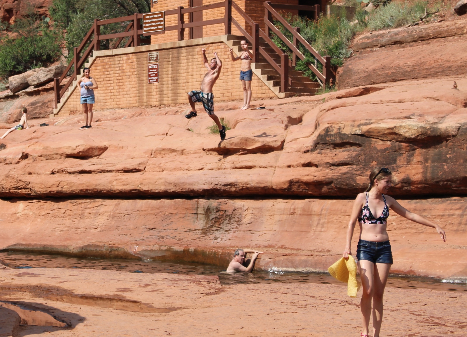
We hung out for a couple of hours, occasionally going in the water to cool off. There was one place where an outcropping of rock on the far bank overhung the water, and occasional brave souls would jump off this platform and drop 15 feet or so into the water. And then one fellow came and showed everyone how it was done with a back flip. (Photos 260) Later on he borrowed a selfie stick with a waterproof movie camera from someone, and did the flip again, all the while filming himself. That must have been an interesting video to watch.
Around mid afternoon, we wended our way back to the parking lot, collected my guitar (Guess the rangers couldn't find a buyer.), and headed north again.
.
Oak Creek Vista
|
|
|
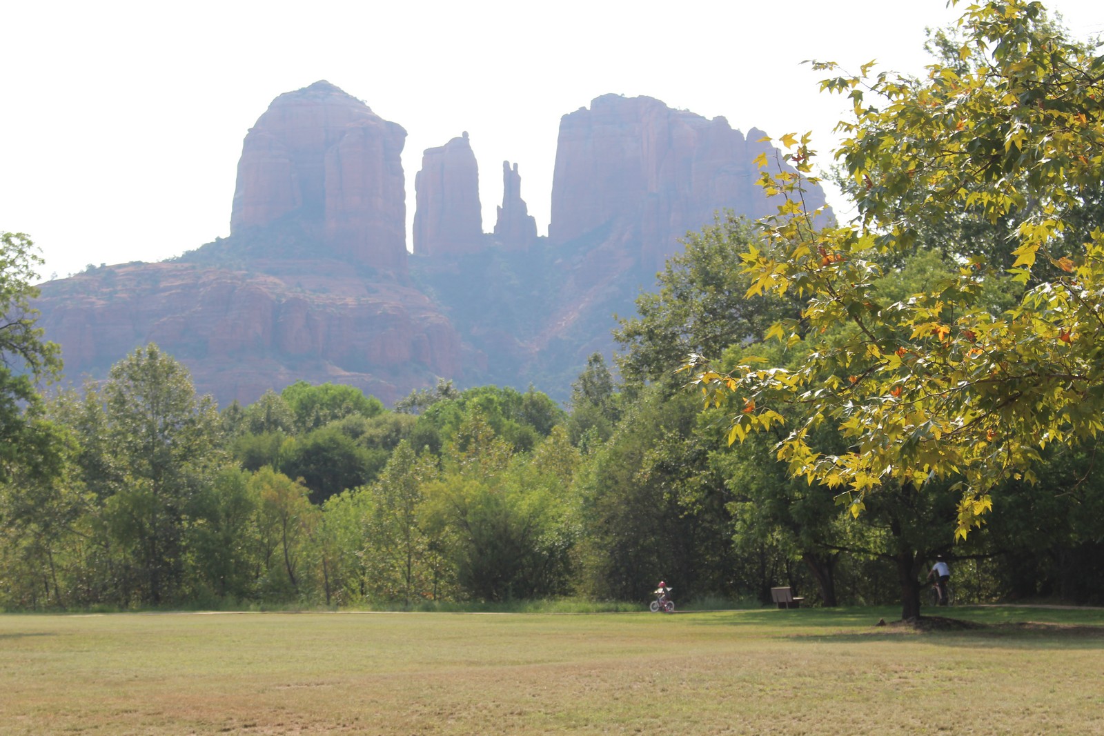
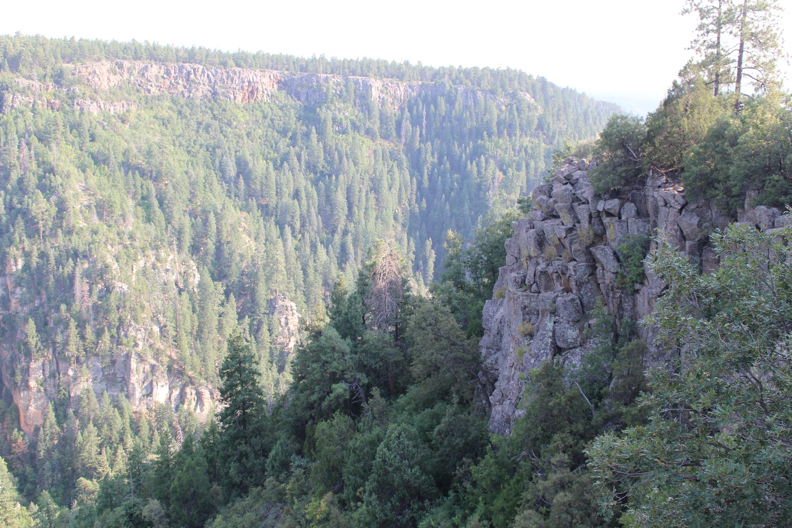
89A continued along the bank of Oak Creek between the towering cliffs of the canyon. After about 5 miles it climbed the eastern wall of the canyon by way of a series of impressive switchbacks and emerged at an overlook. So we obligingly got out and looked it over. This was more like a public park than a quick pulloff. There were picnic facilities and a fairly large area devoted to stalls for the sale of handcrafts of the indigenous peoples of the area. We had arrived just about the time the vendors were packing up their displays, so we didn't shop. We continued on to the overlook, which was pretty impressive. Kinda dwarfed by the Grand Canyon we were to visit the next day, but we hadn't seen that yet, so we were duly impressed.
After a brief stop, we got back in the car and headed north to our Flagstaff lodgings. Here my inexperience with AirbnB came back to bite me. I thought that the lodgings on offer were all comparable to our Cabin on Oak Creek. The Mountain Escape in Flagstaff fell far short. It was entirely my fault; the facilities were clearly described in the literature. I just didn't read it carefully. There was nothing actually deficient about the place. It was just small. We had sort of planned on making dinner there, but there were really no facilities to prepare food, and no place to put it down to eat it once it was prepared. What was most lacking was horizontal surfaces on which to put stuff. We asked the hosts to remove the small TV in the room so there could be room to put my laptop where we could check our email and do necessary internet searches to facilitate our journey. We were continually moving suitcases around the floor so we could get from one side of the room to the other. Fortunately, we hadn't planned on spending much time in the room, so the inconvenience was minimal.
Friday, September 8
Grand Canyon
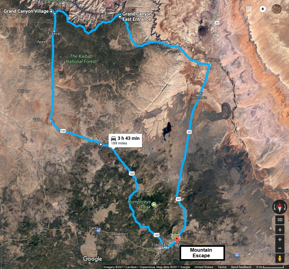
Flagstaff to Grand Canyon |
Grand Canyon detail |
Oboy! The Grand Canyon. Been on my bucket list forever. I was told I was there once when I was 4 years old on a trip with my parents to visit relatives in California. I remember nothing about it save for the fact that I slammed my finger in the car door. And I don't actually even remember that. I just remember being told that happened. We had been monitoring unsettled weather reports for Friday for the past couple of days, and they were still unsettled as we left. Well, the weather would be what it was going to be. We came all this way, and our alternative was hanging around our tiny room. We were going. It was clear in Flagstaff, 90 miles away. If it was gonna rain, it was gonna rain. We brought umbrellas and slickers.
Desert Driving, and the Desert View Watchtower
|
|
|
|
|
|
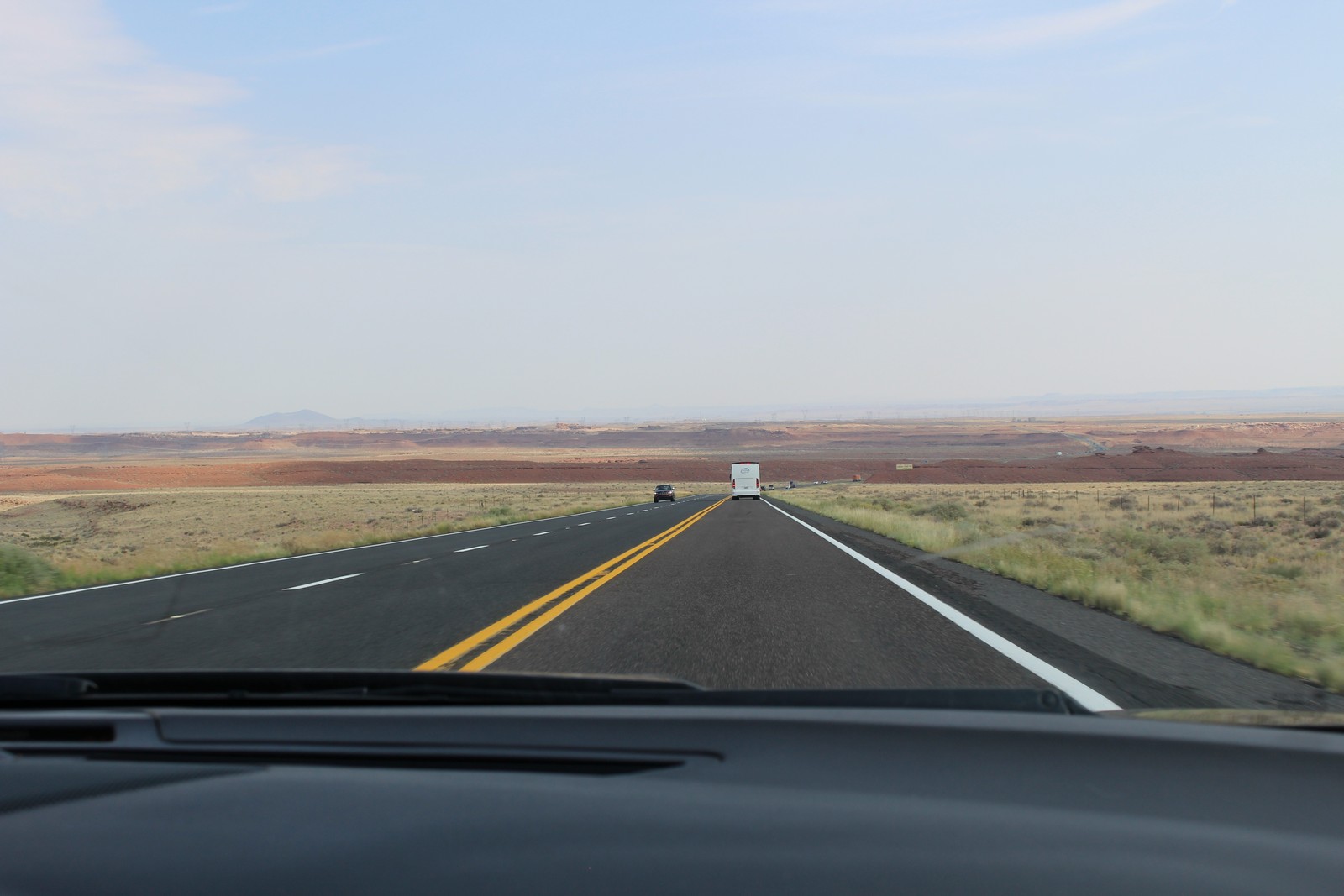
As we left Flagstaff and headed north on Route 89, I got my first real experience of desert driving. The scrubby trees around Flagstaff thinned out to scrub, and then to...nothing. The road ahead, straight as the proverbial arrow disappeared to a vanishing point, and the pavement rolled under our wheels like a treadmill with absolutely no change in the scenery. It was an odd feeling to this easterner to be driving on a non-divided, non-limited-access highway, signed for 65 MPH, and routinely traveled at 75 - 80 MPH by everyone on the road. Including me. And despite this monotony, the both of us managed to miss the only major intersection in 50 miles where Route 64 broke off westward towards the Grand Canyon in Cameron. We went about 15 miles past it until we realized something was wrong, and headed back.
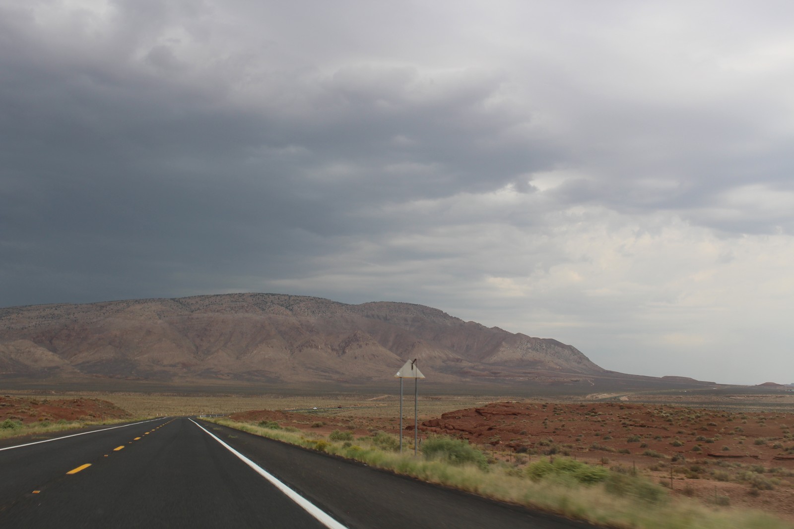
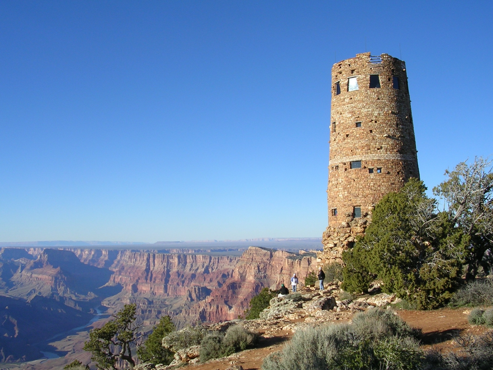
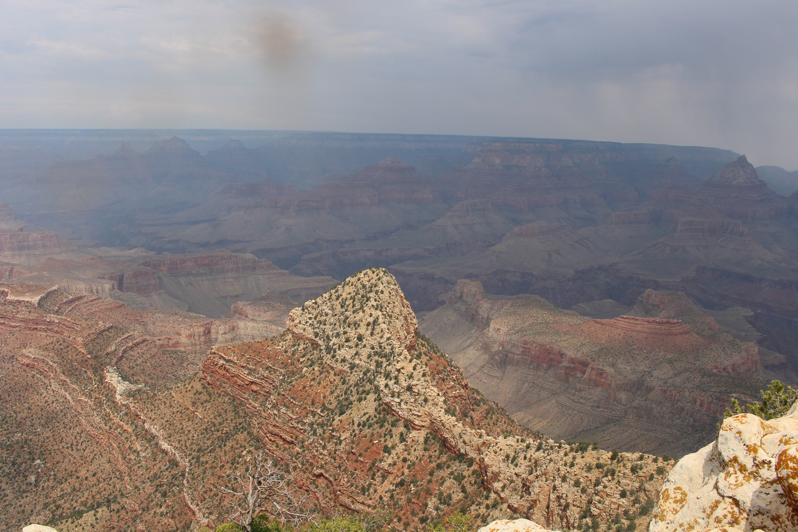
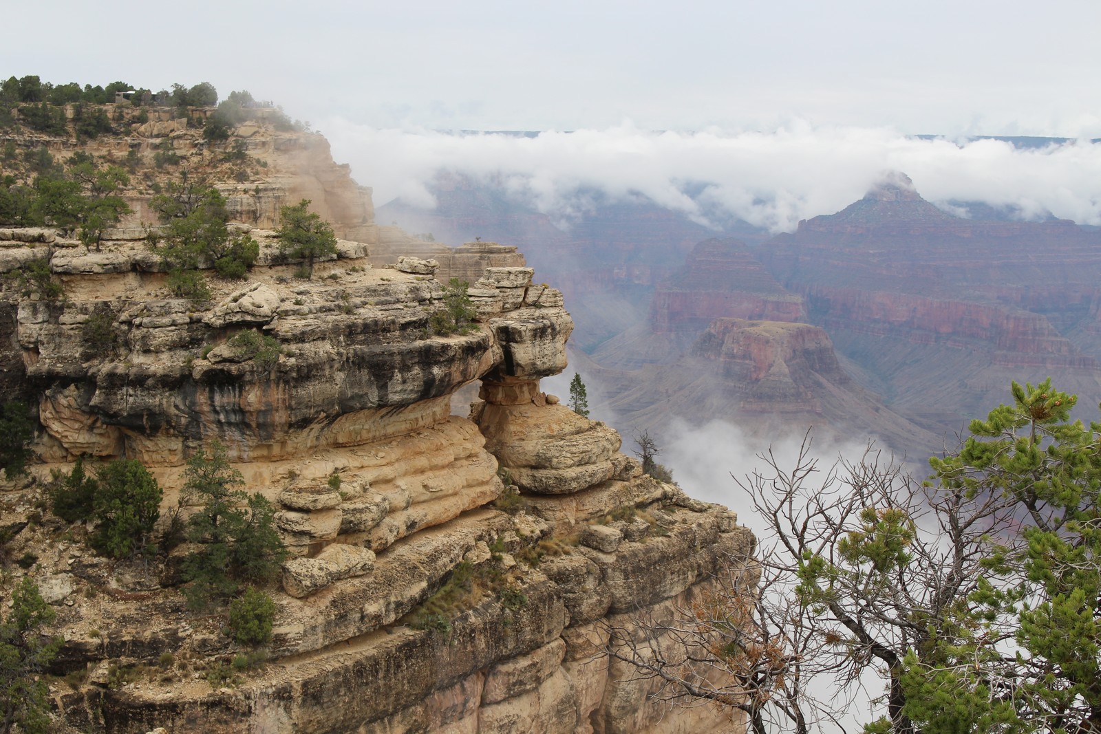
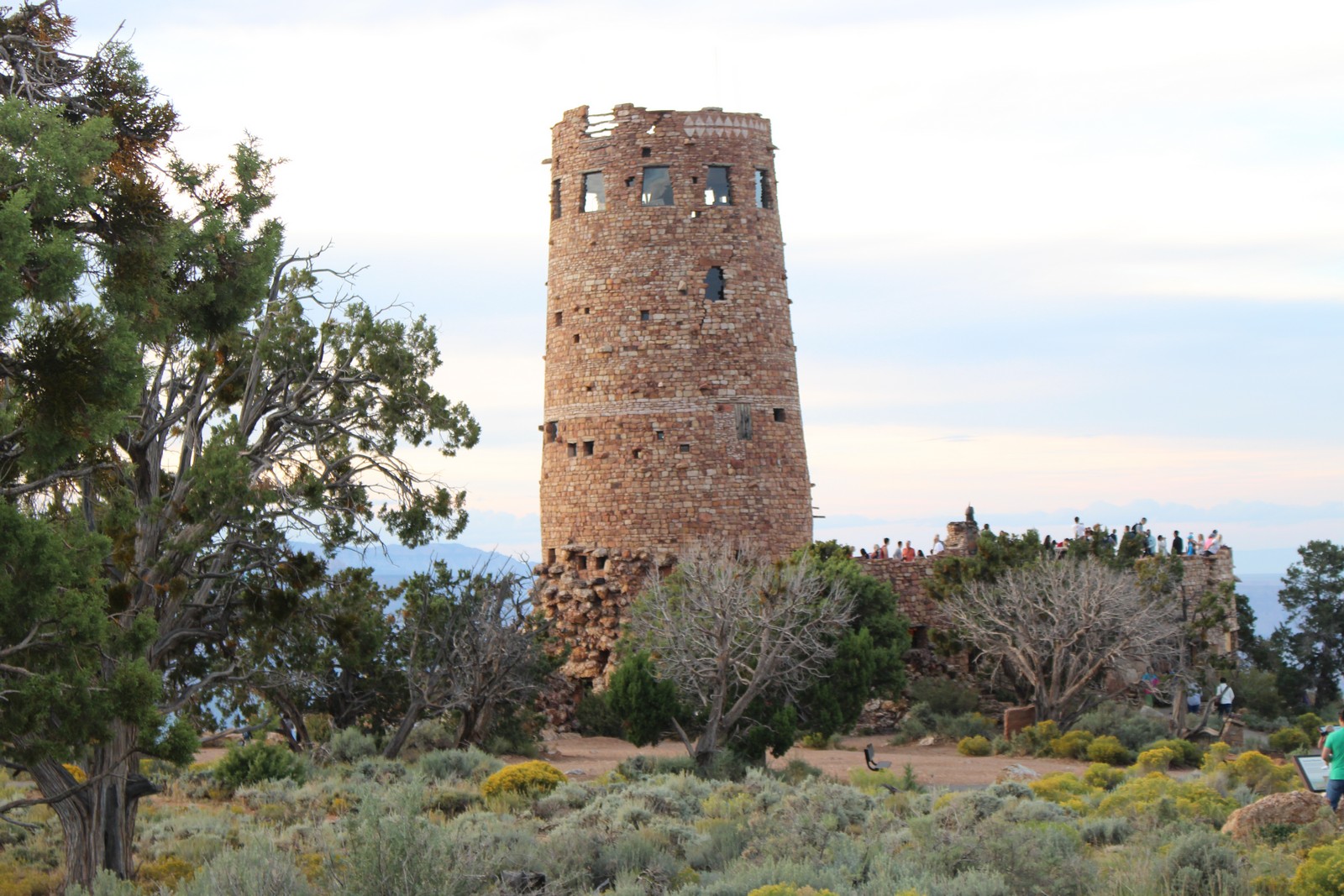
As we approached the eastern entrance of the park, the sky began to grow dark. (Photo 320) Rats! Oh well, At least it'll keep the crowds down. We were greeted by a friendly ranger at the guard house, where I produced my email receipt for my Lifetime Senior Pass, and we were waved on. Watta deal! The first opportunity to get out and look around was at the Desert View Watchtower. And that's when we found out that in addition to our slickers and umbrellas, we shoulda brought our down jackets. It was freaking cold! Somewhere in the 40s with a stiff 25 MPH breeze. The rain was sort of intermittent, and not very heavy. But it was downright unpleasant out there.
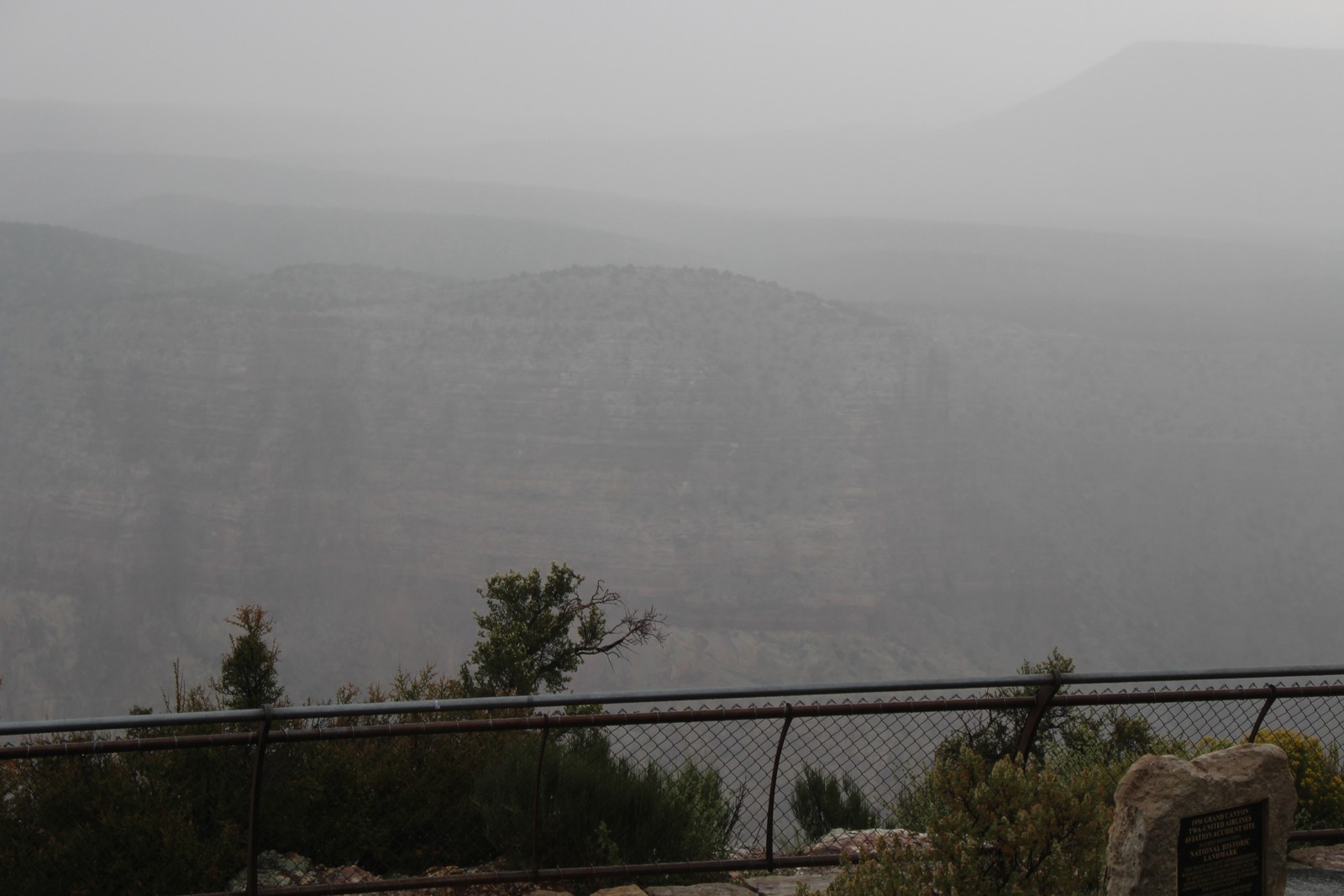
The Desert View Watchtower is an impressive stone tower perched on the rim of the Canyon. The views would have been impressive if it weren't for the fog. (Photos 330 & 340). It was only after leaving the Watchtower that I realized that while I had taken a number of photos from the parapets and overlooks, I had never taken any shots of the Tower itself. So I nicked Photo 360 from Google Images.
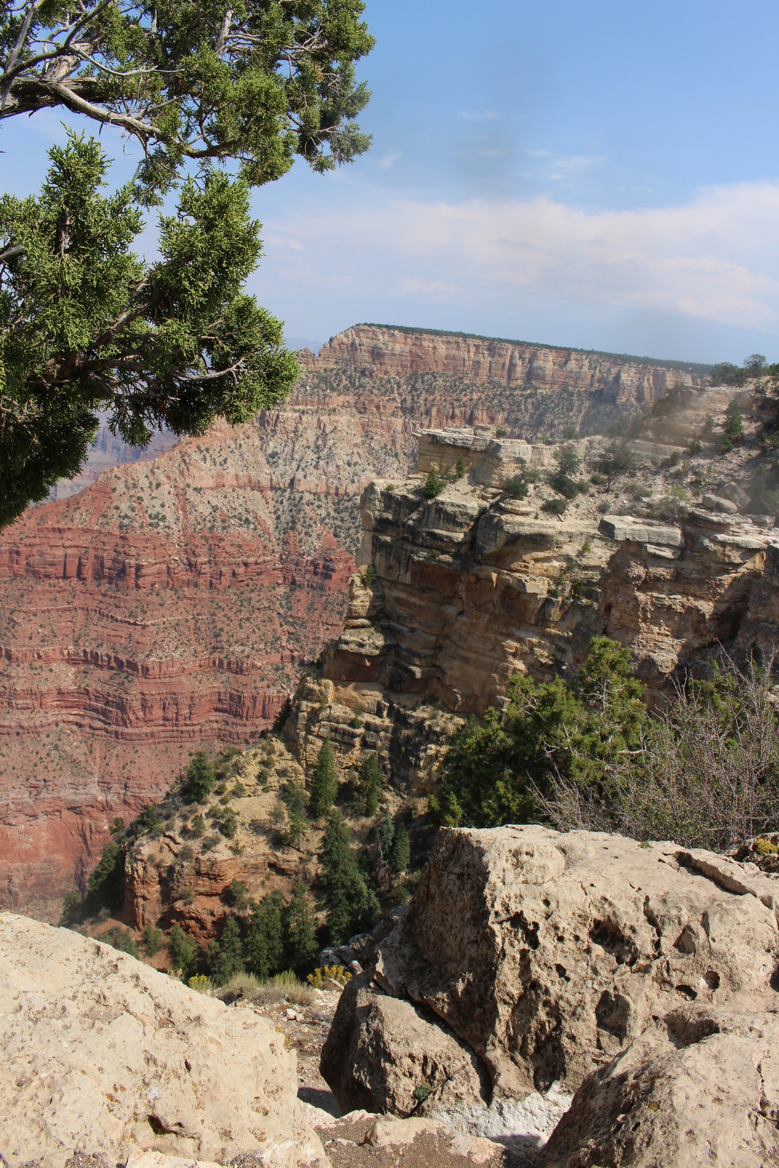
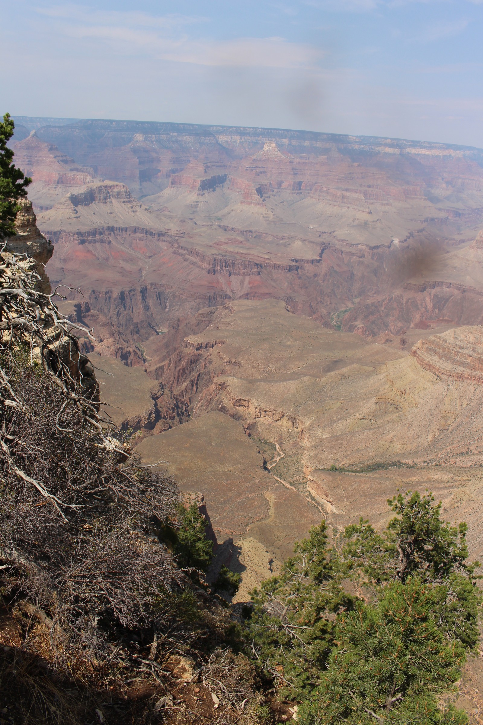
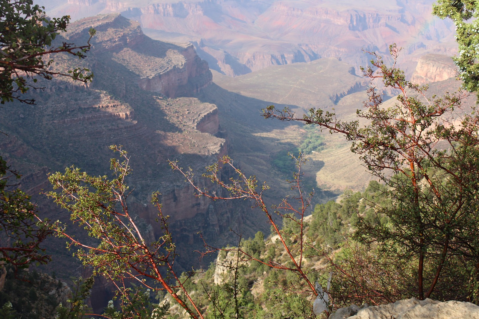
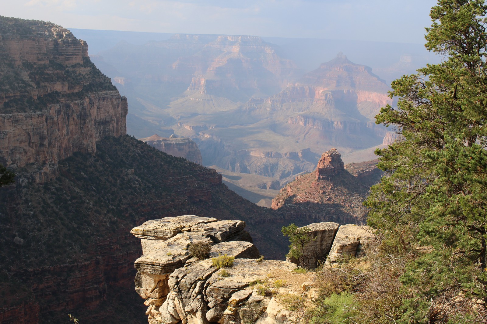
Grandview Point
|
|
|
|
|
|
|
|
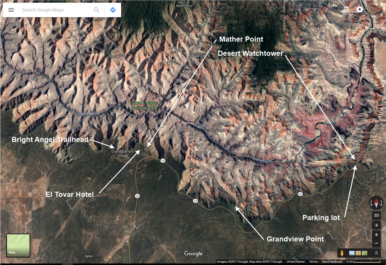
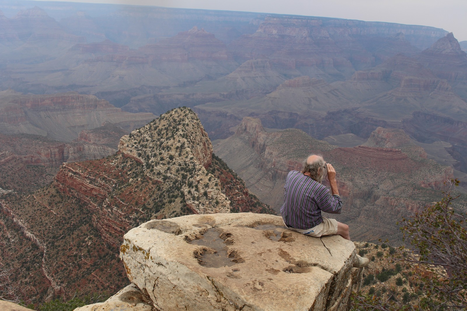
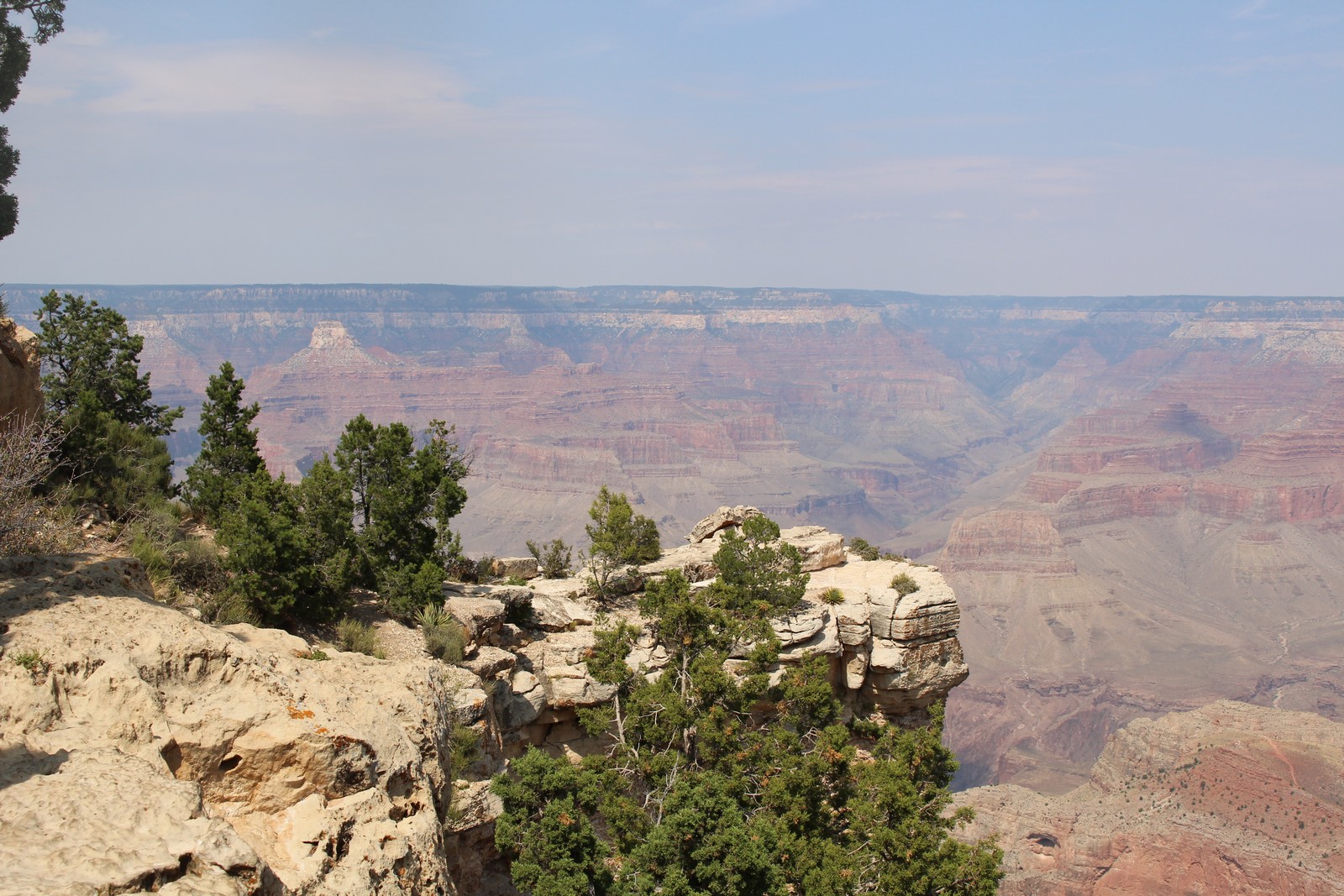
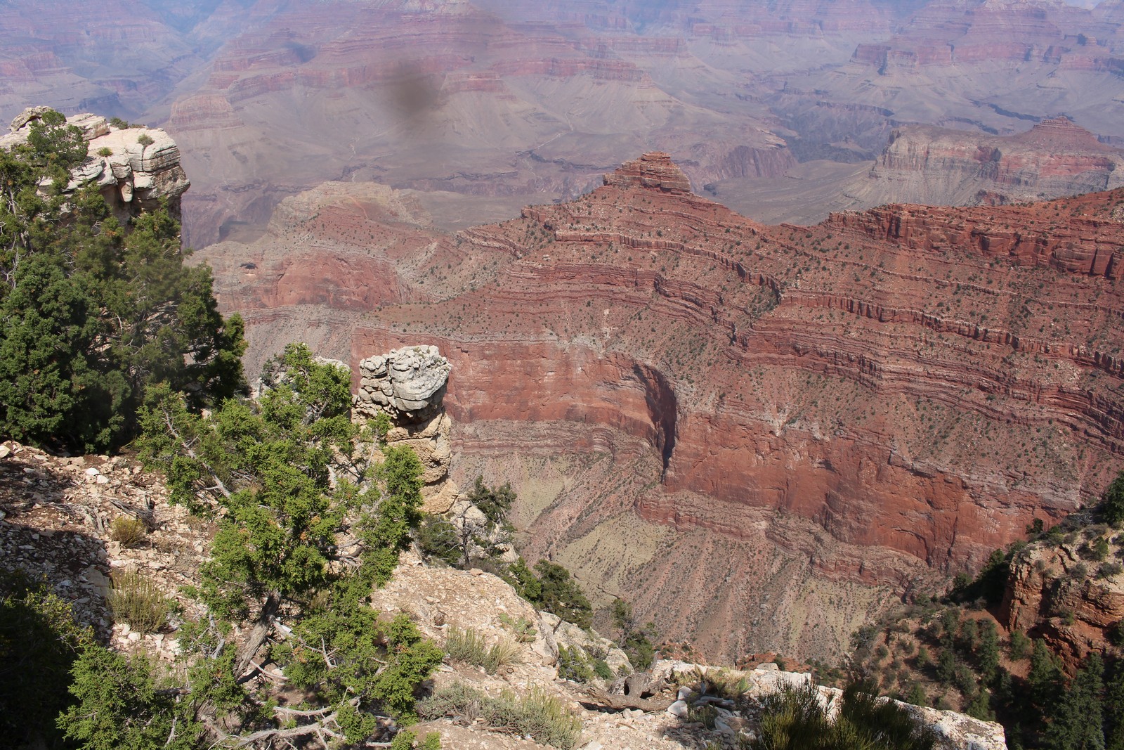
The park sprawls along 50 or 60 miles of the Canyon's rim. You can drive about half its length. The rest, as well as the length you can drive, is accessible by a pretty elaborate network of free busses. The purpose, of course, is to minimize the vehicular traffic. And the system works pretty well. All along the route are various observation points and overlooks where one can get out and gaze at (ho hum) yet another spectacular view. We determined to drive to Grandview Point next.
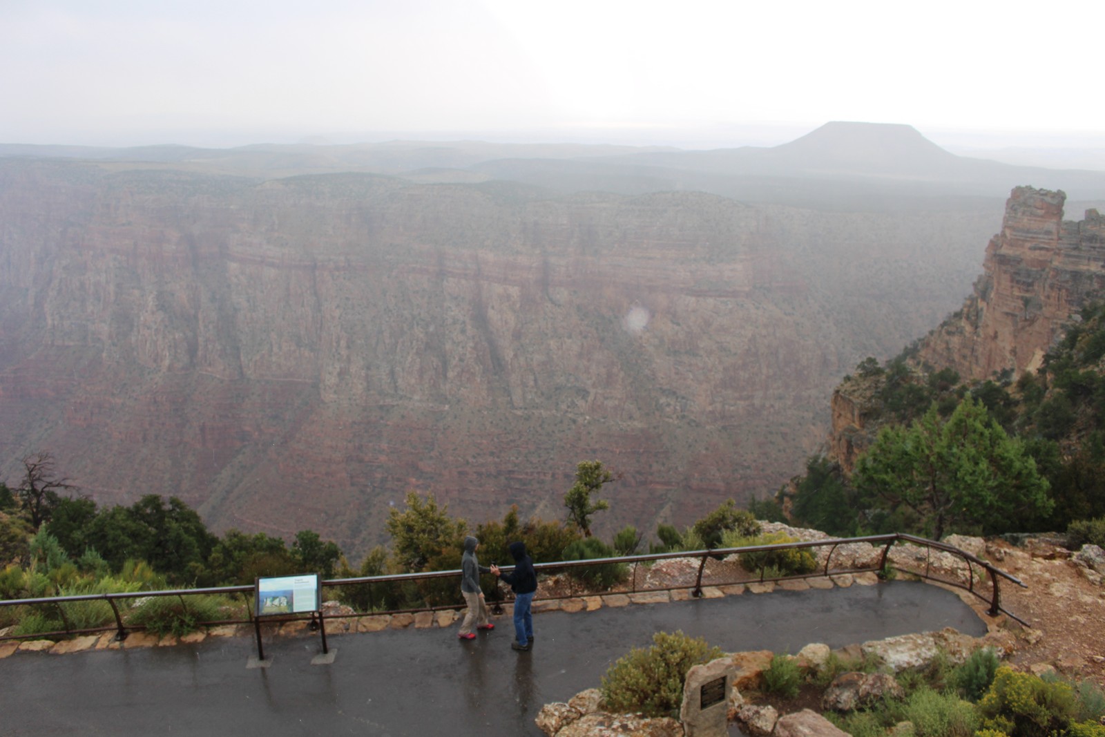
We got back in the car, thankful for its heater, and headed west. The weather did seem to be lightening up, and by the time we got there, one could at least see to the bottom of the canyon. It continued to clear and warm up, and the rest of the day saw fine weather. And yes, the rainy morning had indeed kept the crowds down.
It became clear to me that the Grand Canyon is yet another one of those things one can simply not capture in a photograph. I once again did try to present the scope of the place with a panoramic video (460), but with only limited success. Nonetheless, I took a bunch of stills, and present them to you above. None of them really require any verbal elaboration except perhaps Photo 420. I've never been bothered by heights. So it was no big deal for me to perch on the edge of that rock and survey the world before me unimpeded by any obstacle. I remember an incident when I was around six when my grandmother walked into my room, and lost several years of her life when she discovered me sitting on the windowsill of my room on the 6th floor of our apartment building with my legs dangling out over the edge. As she frantically snatched me back into the room, I didn't understand what she was so upset about. I knew how to sit without falling out of my chair.
Mather Point
|
|
|
|
|
|
|
|
|
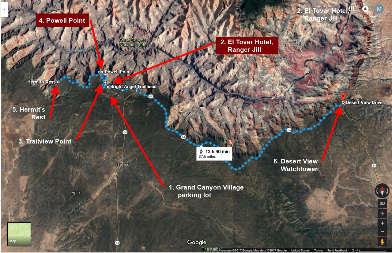
About midway along the South Rim, there's an area called Gand Canyon Village. It's sort of a central hub, with another entrance to the park, several viewpoints, a large parking area, a number of hotels, restaurants, and trading posts, the main terminus for all the bus routes, and the trailhead to the path down to the bottom of the Canyon. That was our next stop. The weather was pretty much clearing up as we arrived. The puddles were drying up on the paths and it was getting warm enough to be pleasant.
The park presents lectures by the rangers on various subjects. There was one conveniently scheduled on the California Condor, so we decided to attend. It was well presented, if a little hokey in spots, and I learned a lot. I learned that the species had depleted to less than 100 birds in their native California habitat, and it was only discovered at the very last minute why. The condors are carrion birds, and they were dying from, of all things, lead poisoning, caused by lead shot in the dead birds they were eating. They were, in effect, being exterminated by hunters, even though they were not the targets. A vigorous program was instituted to capture all the remaining birds, breed them in captivity, and then release them to the wild. This was a difficult, and not always successful effort. One of the issues was, of course finding suitable habitats for them. They required nesting space on cliffs, protection from hunters, plenty of food, and isolation. Somebody said, "Hey! I know of just such a place." So the Grand Canyon, while not their native habitat, became a perfect release area. Their numbers are growing slowly. They no longer in extreme danger of extinction, but not entirely out of the woods yet.
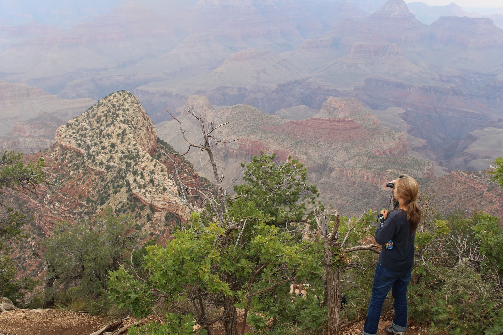
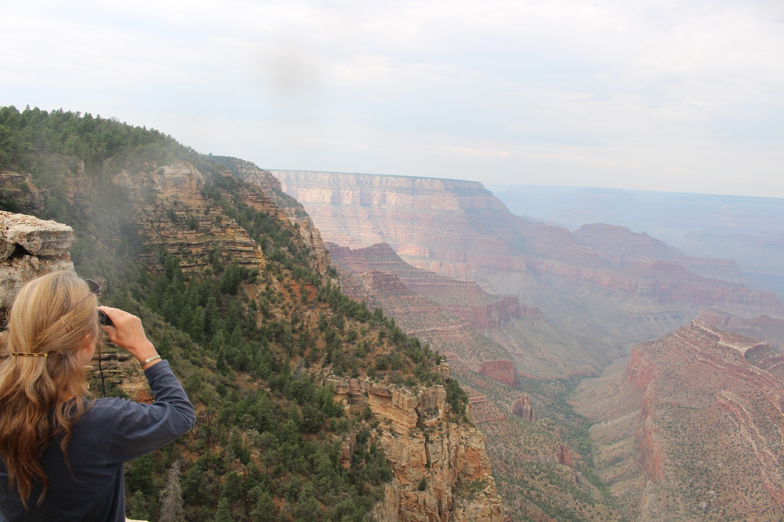
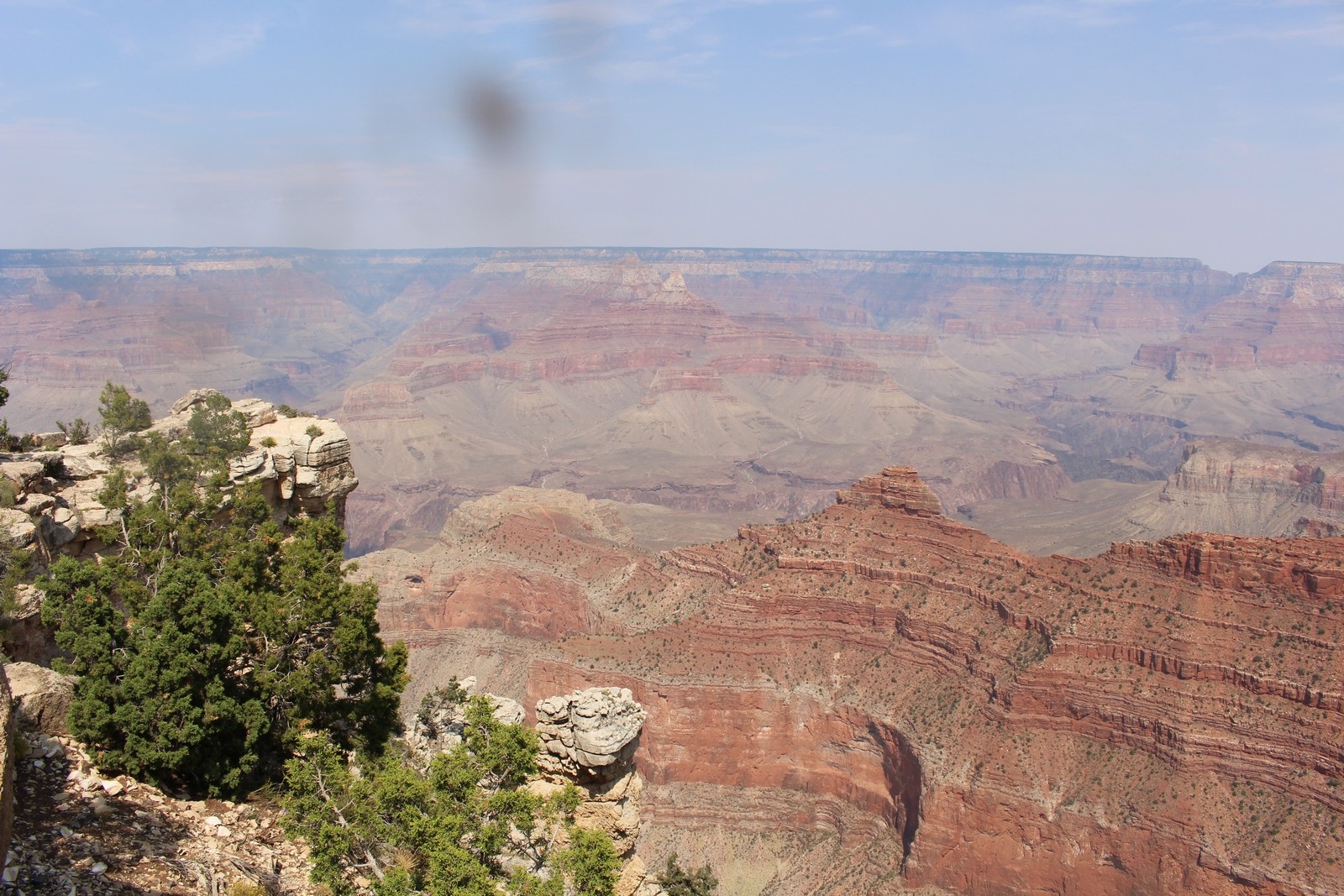
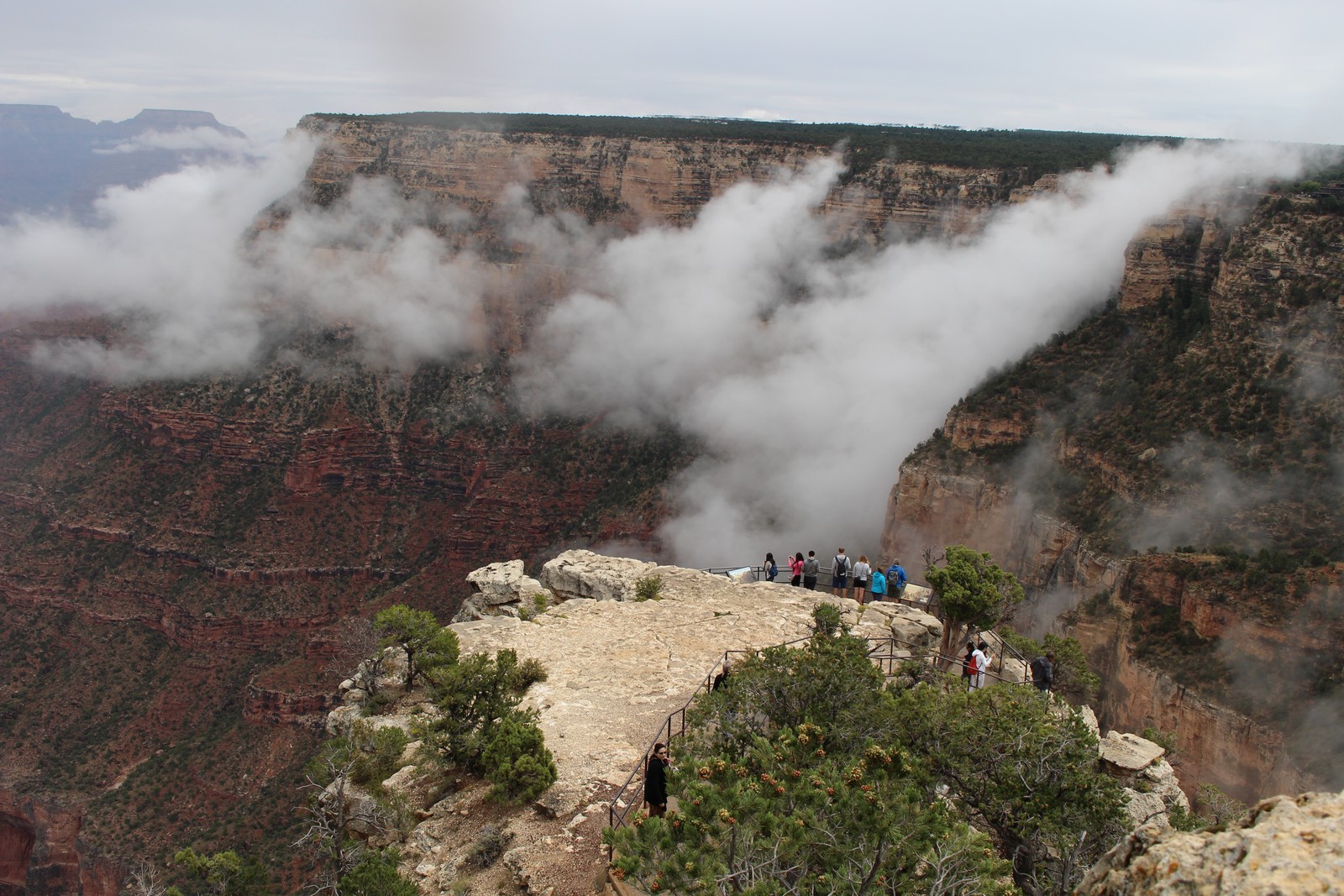
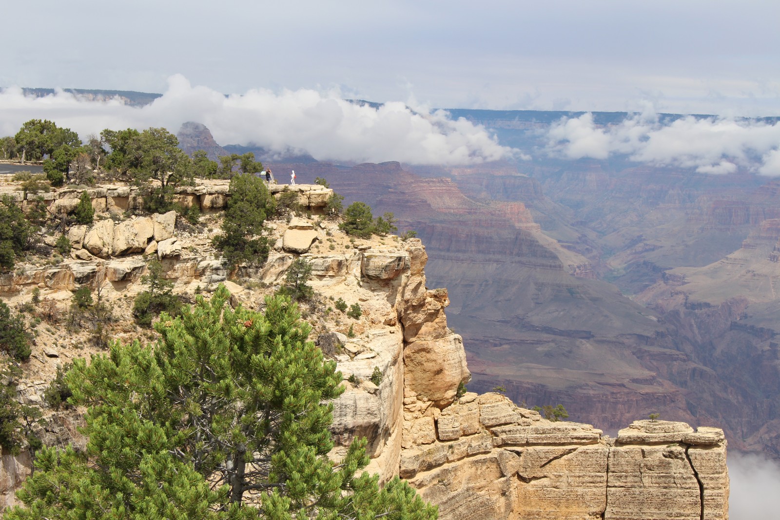
We grabbed a bite somewhere and then went to look at Mather Point. It was similar to Grandview in scope, but different, of course, in detail. I particularly like Photo 570, because the human figures on the observation point start to give an inkling of of the scale of the Canyon.
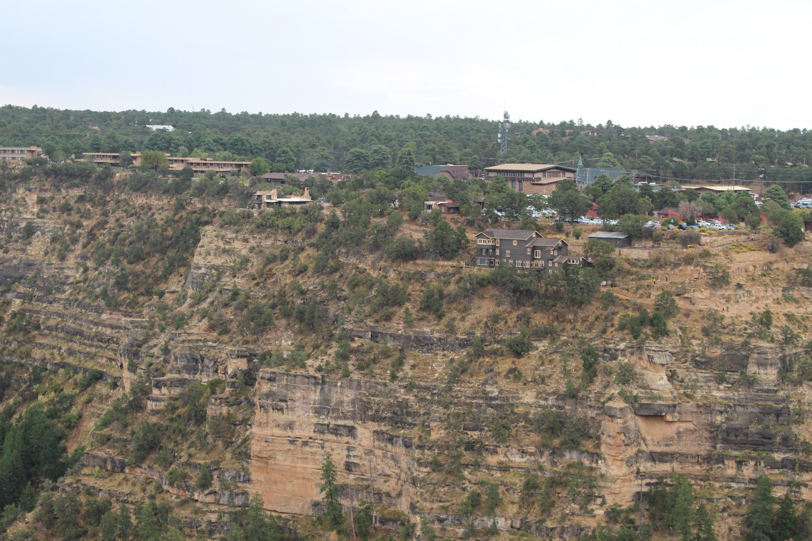
El Tovar Hotel and Bright Angel Point
|
|
|
|
|
|
|
|
|
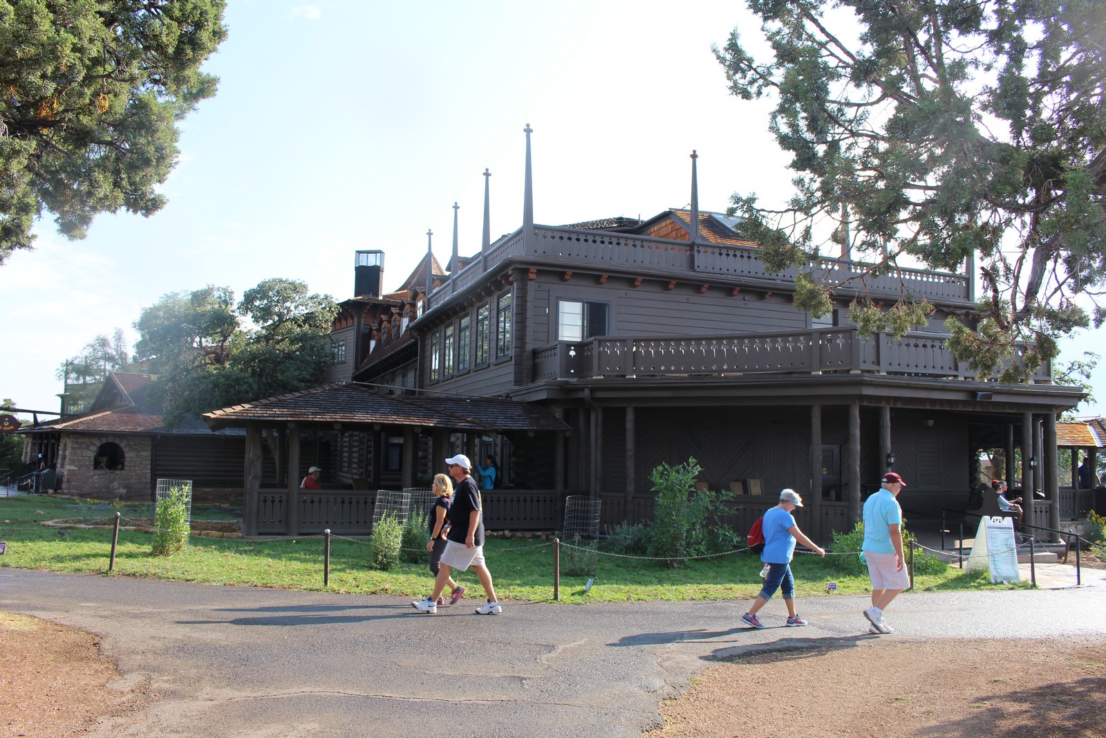
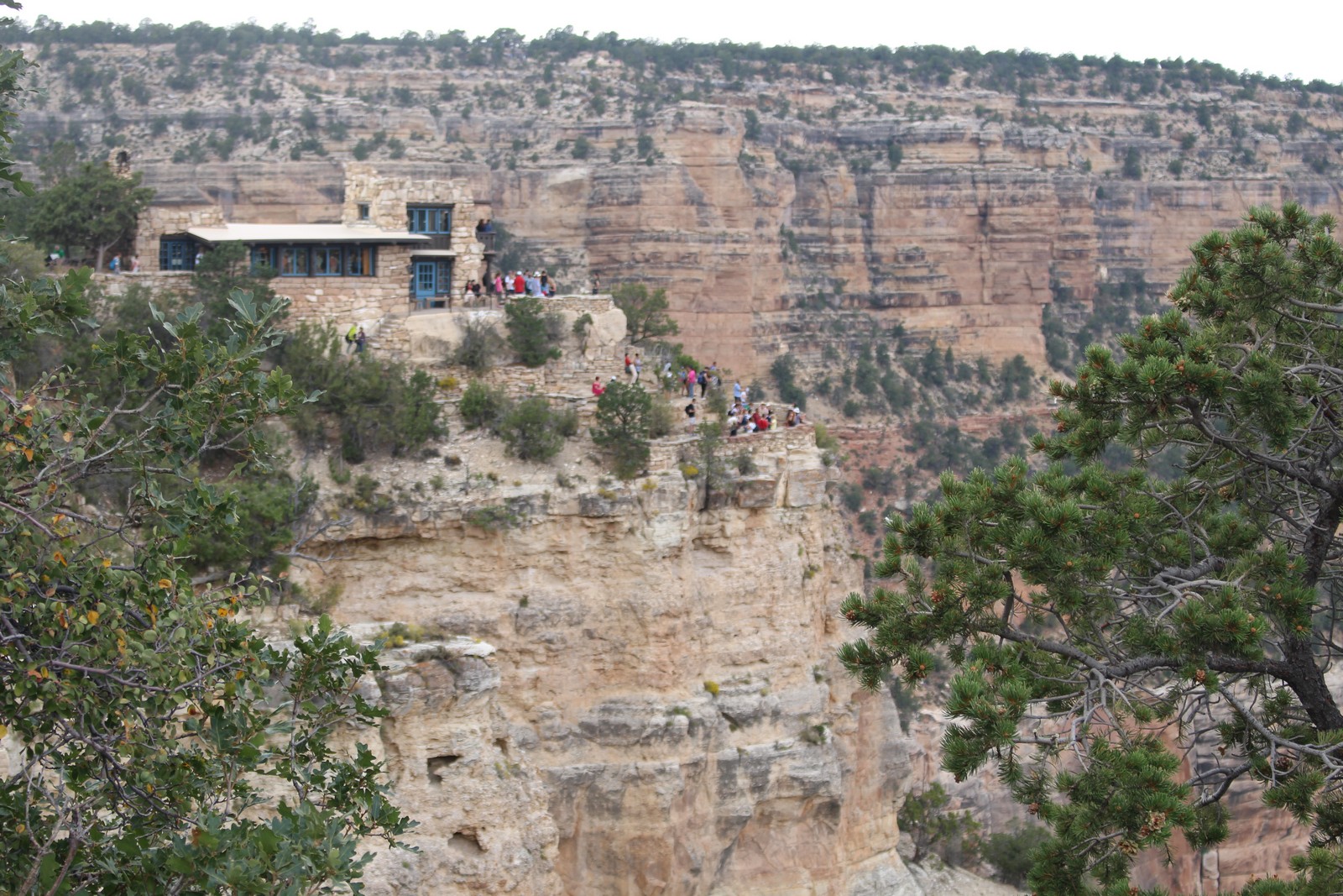
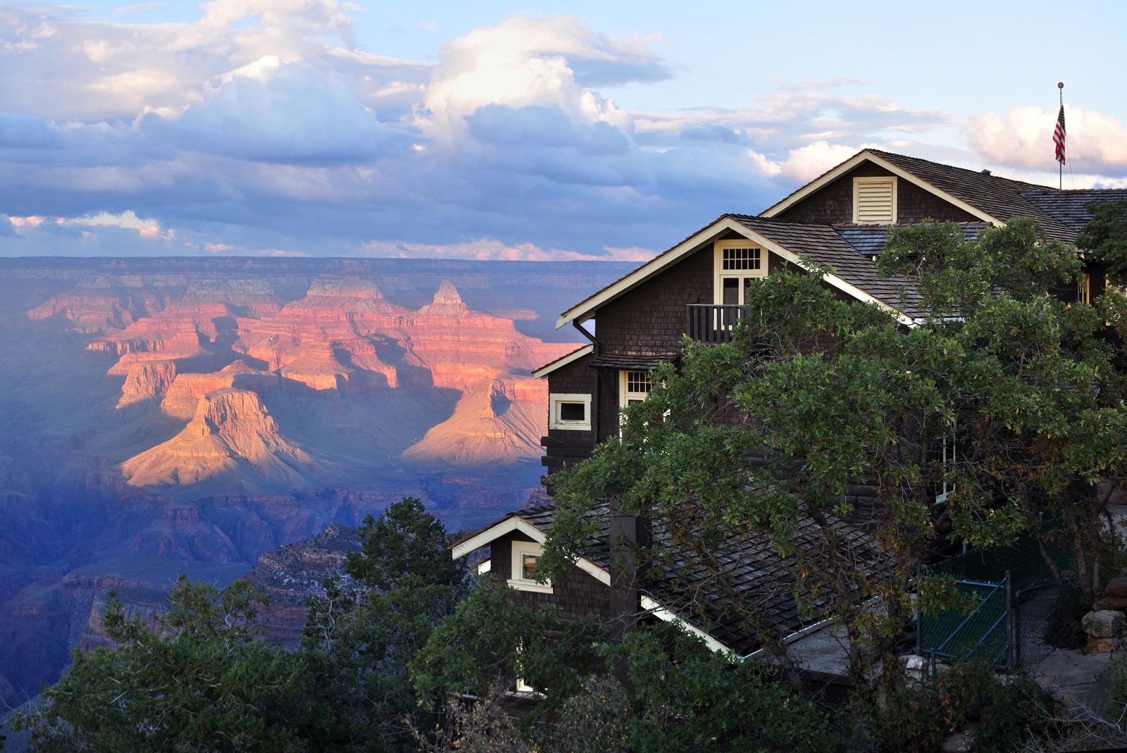
One of the offerings in Grand Canyon Village is the El Tovar Hotel. This is a fancy-schmancy lodge built by the Harvey Company in the early 1900s in conjunction with the Santa Fe Railway. It was designed as a tourist destination to build up passenger traffic on the railroad. It's only a couple of steps away from the rim of the Canyon. (This is quite similar to the Fairmount Hotel chain's arrangement with the Canadian Pacific Railway described in my 2012 Canadian Rail Tour.) I poked around the lobby some. Very classy. I thought maybe it would be worth a return trip sometime, and not have to drive an hour and a half to and from the Canyon each day. I picked up a brochure. Woah! Talk about sticker-shock! Yeah, maybe I could afford it. But I couldn't justify it.
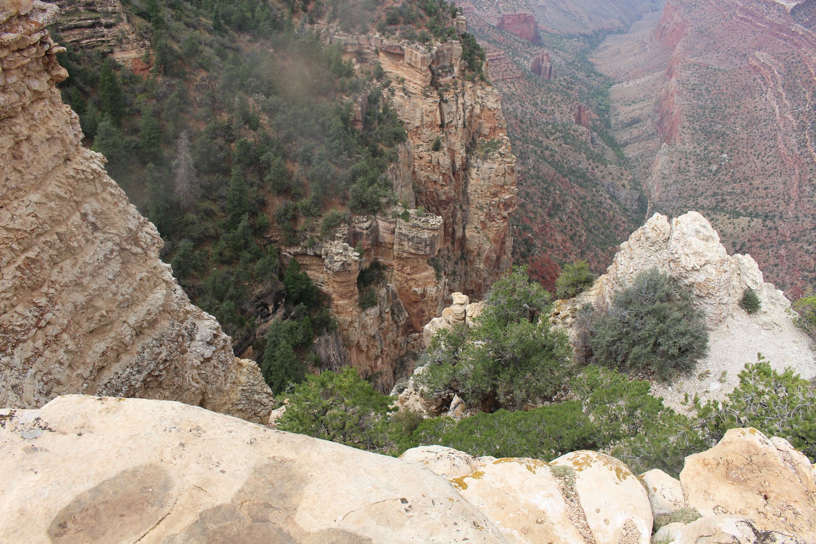
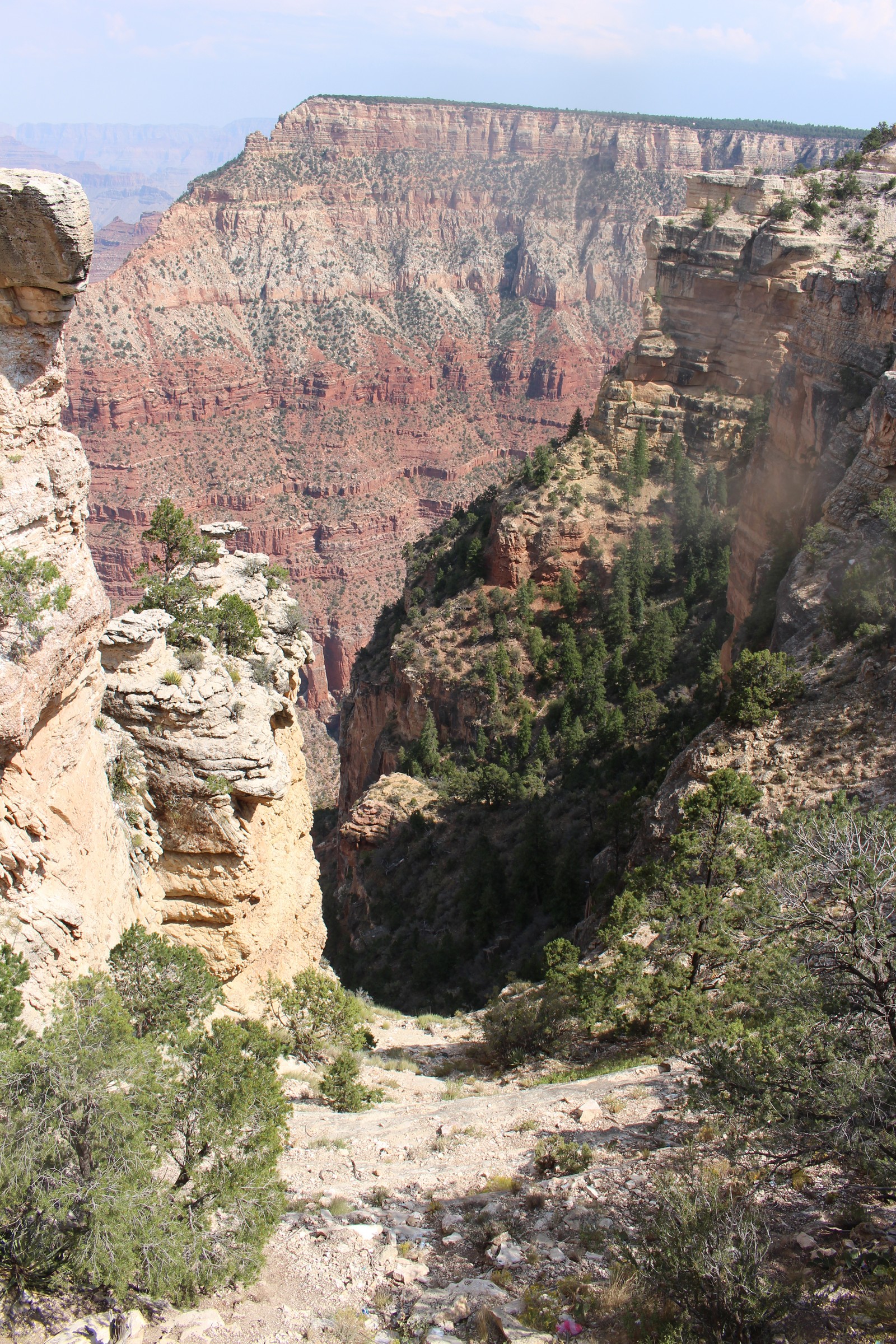
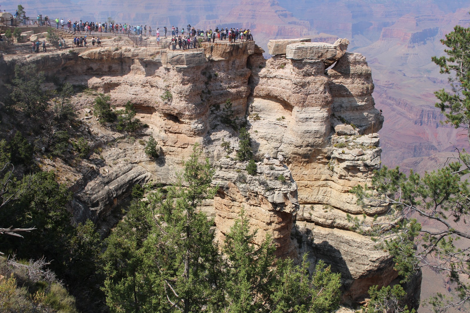
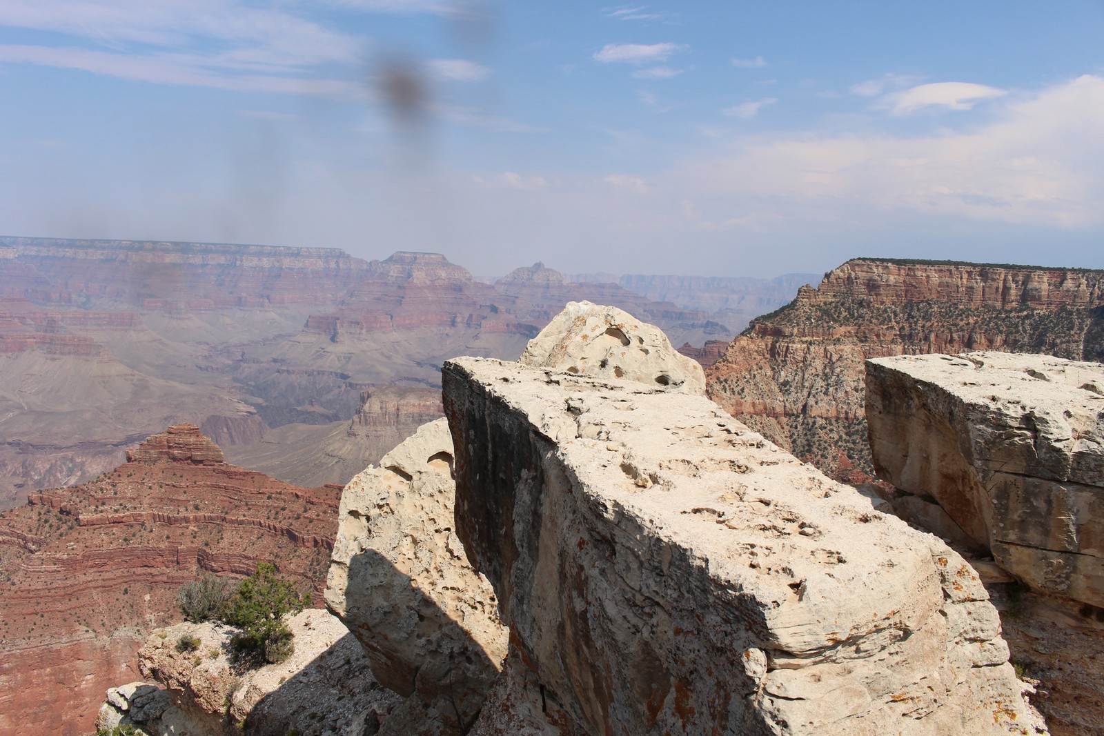
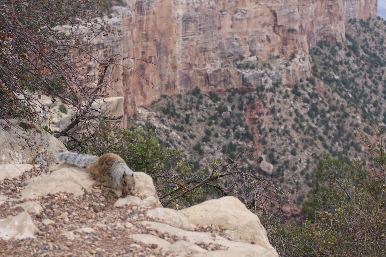
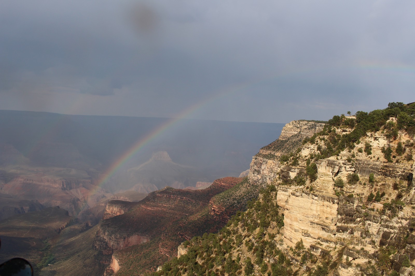
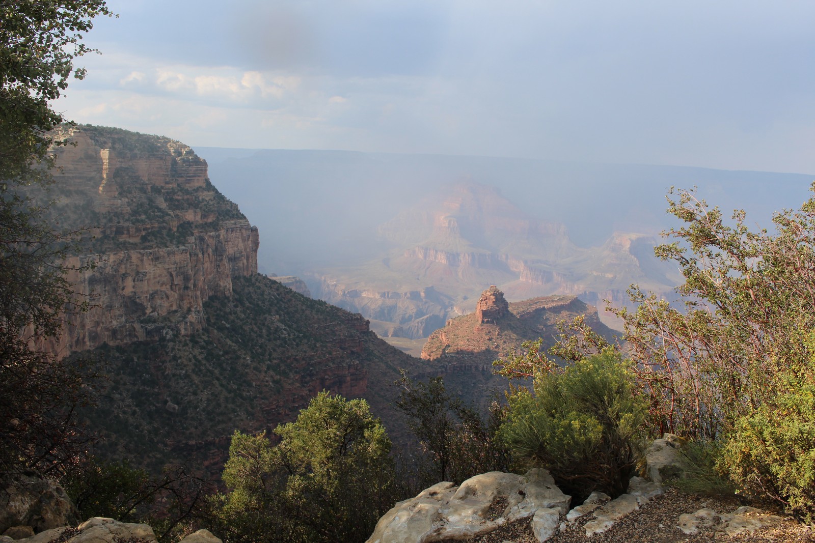
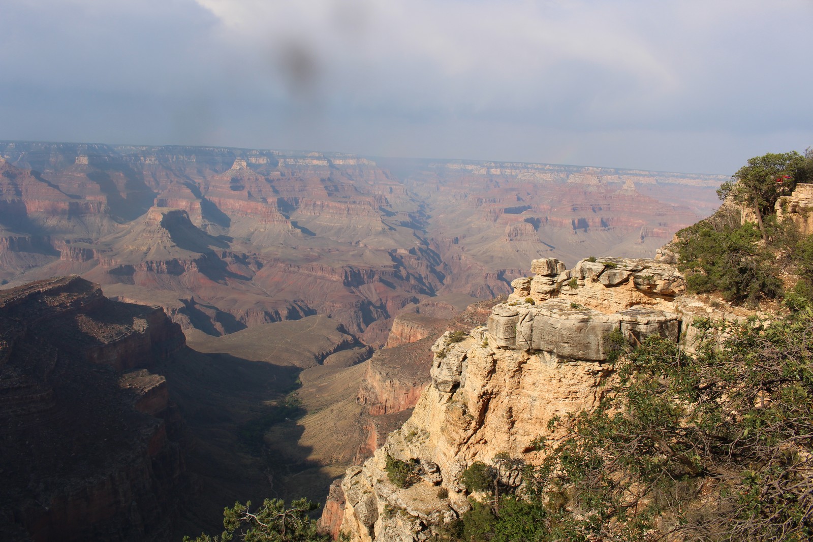
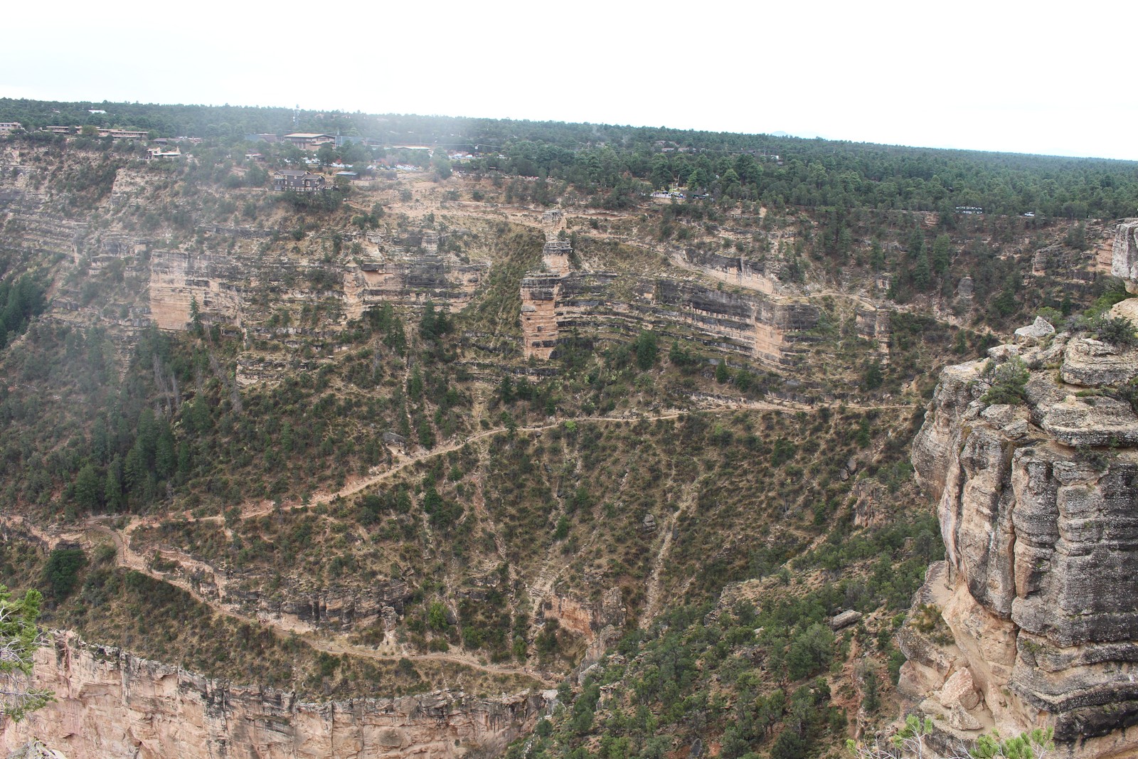
Bright Angel Point is yet another place where the the high plateau upon which Grand Canyon Village is situated projects out into the Canyon, offering more spectacular views in a 180° sweep. Photo 620 is a shot of the point itself, showing the observation area, from which most of the other shots in this collection were taken. At one point we were treated to a bright rainbow as a patch of mist caught the sun. The fauna in the area are very used to humans, and I nearly stepped on the squirrel in Photo 630 before I saw it. It's also from this area whence Bright Angel Trail departs. That's the route the intrepid hikers and donkey riders take down to the river at the bottom of the Canyon. If you look at the full screen version of Photos 610 and 660, you can just make out the trail, running up the middle of the photo. That's a full day's journey for people a lot more fit than I.
That was a full day for us. We packed up and headed for home, leaving by the South Rim Park entrance. This time, rather than trying to use the inadequate food preparation facilities of the room, we stopped for dinner at a place in Flagstaff called the Railroad Diner. It was an old Howard Johnsons restaurant from the days of the classic Route 66 Mother Road across the country, and decorated in appropriate style. It was situated along a very active railroad line, along which several endless freight trains passed during our dinner. To complement the real thing outside, there was a Standard Gauge model railroad track circumnavigating the diner on a ledge about 10 feet up on the walls with a train that passed by every two minutes or so. Kind of charming. The food was OK.
Saturday, September 9
Grand Canyon
Note: Our driving route map was the same as that of September 8, except we made the loop clockwise instead of counter-clockwise.
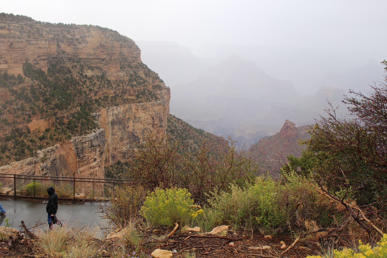
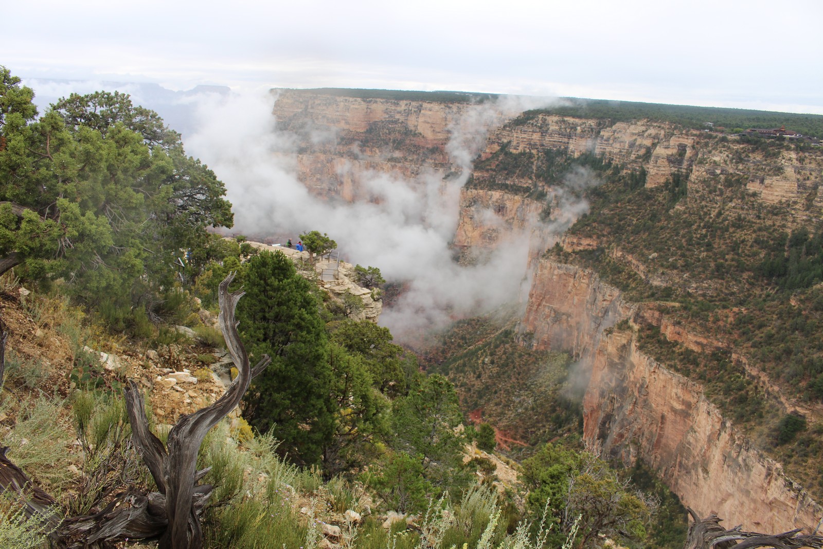
We got an early start on Saturday, despite the weather predictions of rain and wind and temperatures in the high 40s. The predictions were accurate, and I donned flannel shirt and sweater, and brought the tattered remains of my umbrella with me. This time we accessed the Park by the South Entrance at Grand Canyon village. The weather again discouraged the usual Saturday crowds, but it was decidedly unpleasant conditions in which to be skirting the edge of thousand foot cliffs. So we decided to postpone our wanderings, and check out some indoor attractions.
Morning activities out of the weather
|
|
|
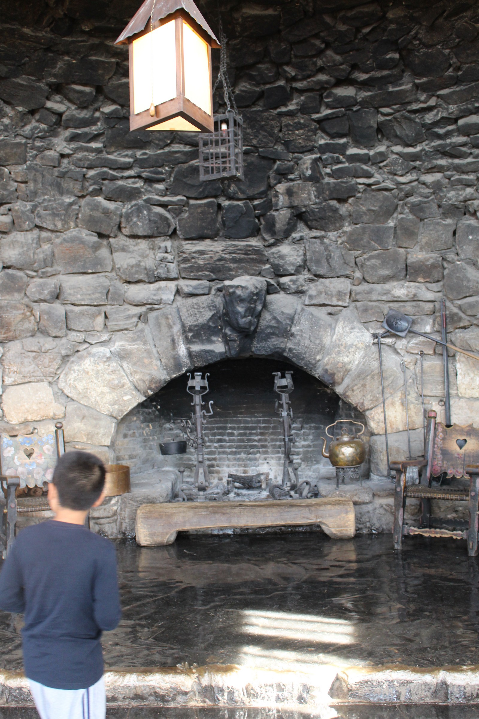
We poked around the Kolb Studio. This was originally a private residence and photography studio built starting in 1902 and operated by the brothers Ellsworth and Emery Kolb. This, of course, was an era in which photography required a fairly well-equipped chemistry laboratory to process the images. It remained a private building until 1976, when it was transferred to the National Parks service upon the death of Emery. It was converted to a gallery, focussing on the work of the Kolb Brothers, and other Grand Canyon imagery. There were many fascinating photos there of the Canyon at the turn of the 20th Century, and other attractions. But chiefly, it was warm and dry.
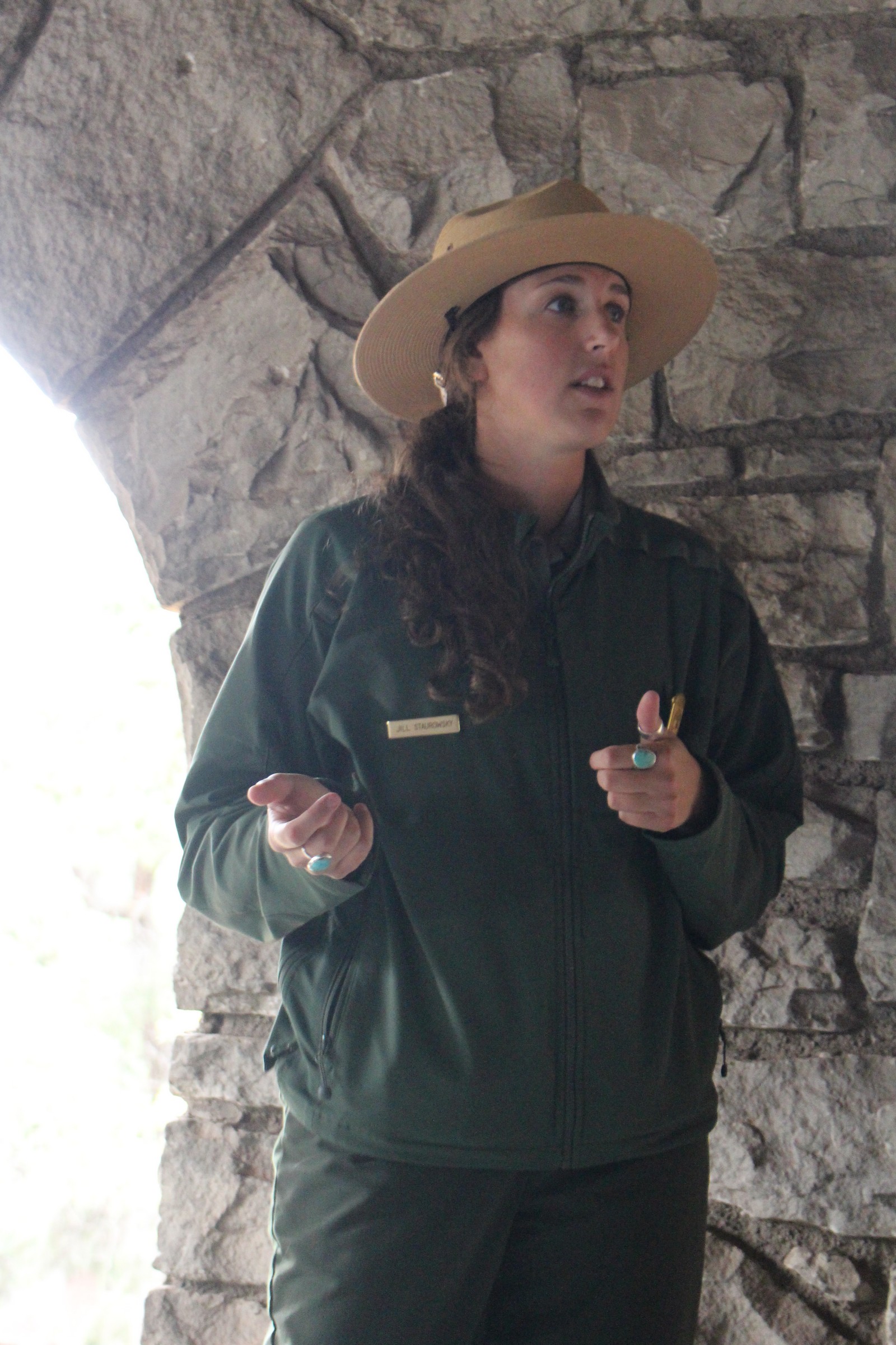
The gale had started to abate, but it was still no fun to be outside. So we decided to attend another lecture presented by the Rangers. The one that was scheduled conveniently was on the History of Women in the Park Service, given by Ranger Jill Staurowsky. Not exactly at the top of my list of things I was dying to learn about, but at least it would be out of the weather. Well Ranger Jill was about to open my eyes. We convened in the massive stone veranda of the El Tovar Hotel, and Jill held forth. It was a classic example of how a committed, knowledgable, and impassioned lecturer can completely involve her listener in her subject. She told fascinating stories about some of the first women in the Park Service, and their struggle to achieve status, responsibility, and equality with the men they worked beside. Had me completely captivated. She was good!
The Birds
|
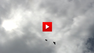
The rain had stopped, but the clouds still loomed ominous. But we ventured west on the Rim Trail to see what we could see. And what caught my eye there, as it had the previous day, were the birds. A colony of ravens (I think. Someone correct me if I'm wrong.) inhabits these regions. And they would amuse themselves, and me as well, by cavorting about the cliffs and valleys in what I could best describe as dances of wild abandon. They wheeled and soared and zoomed, often in pairs, and occasionally in pairs of pairs, with no apparent practical purpose other than the sheer joy of doing it. At times it would appear to be competitive and combative, and then it would look like a team effort of formation aerobatics. I tried to capture it as best I could with my camera, but I can safely predict that the National Geographic Society is not about to recruit me as a staff videographer anytime soon. It didn't help that the viewfinder of my camera is not functional in video mode, and the daylight rendered the view screen of the camera almost useless. But just shooting from the hip, as it were, I caught this footage of the action. And all I could say at the time was, "I wanna DO that!"
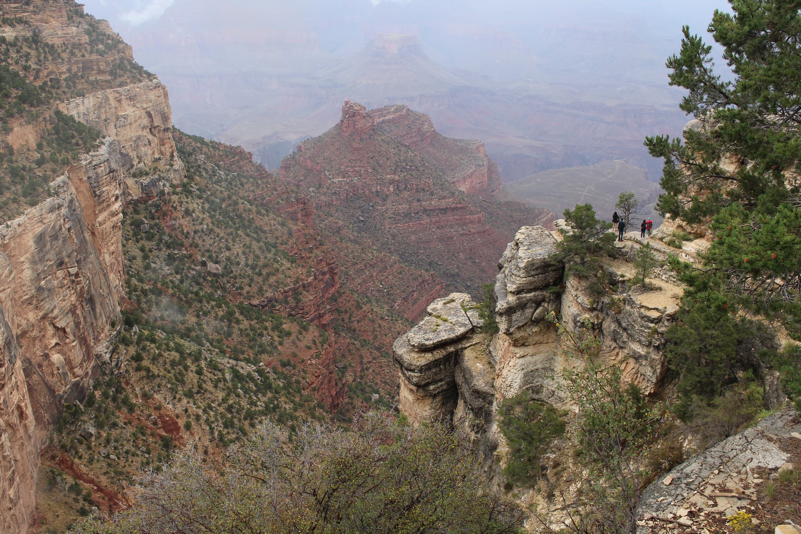
Trailview Point, Powell Point
|
|
|
|
|
|
|
|
|
|
|
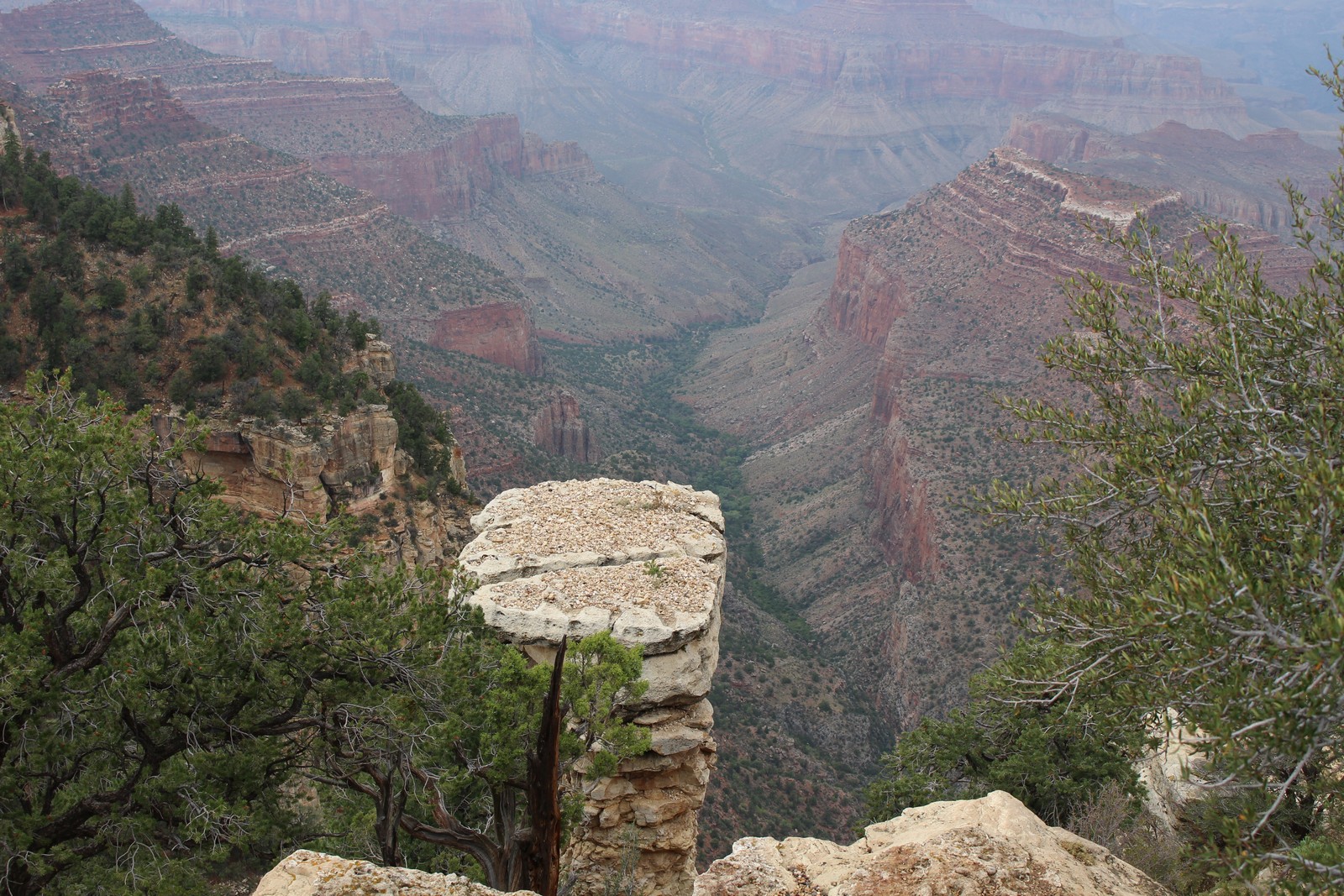
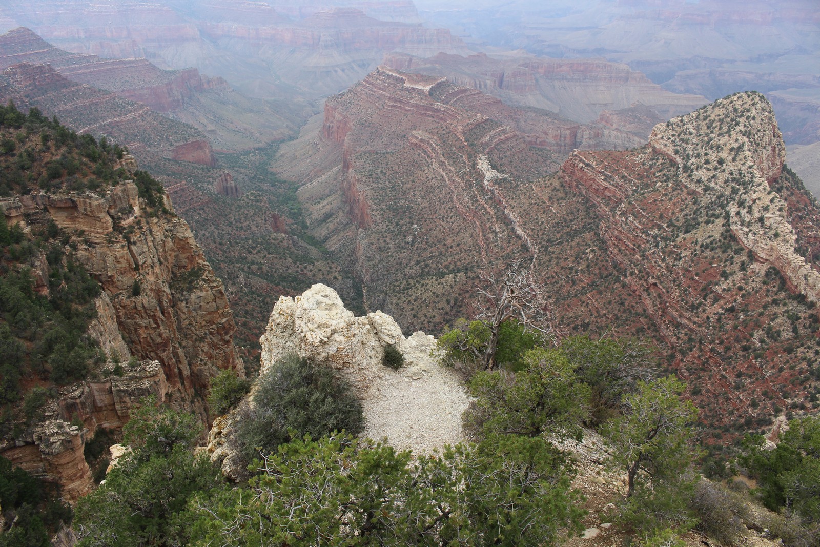
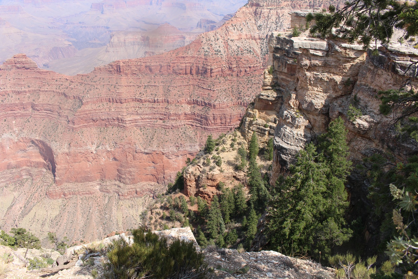
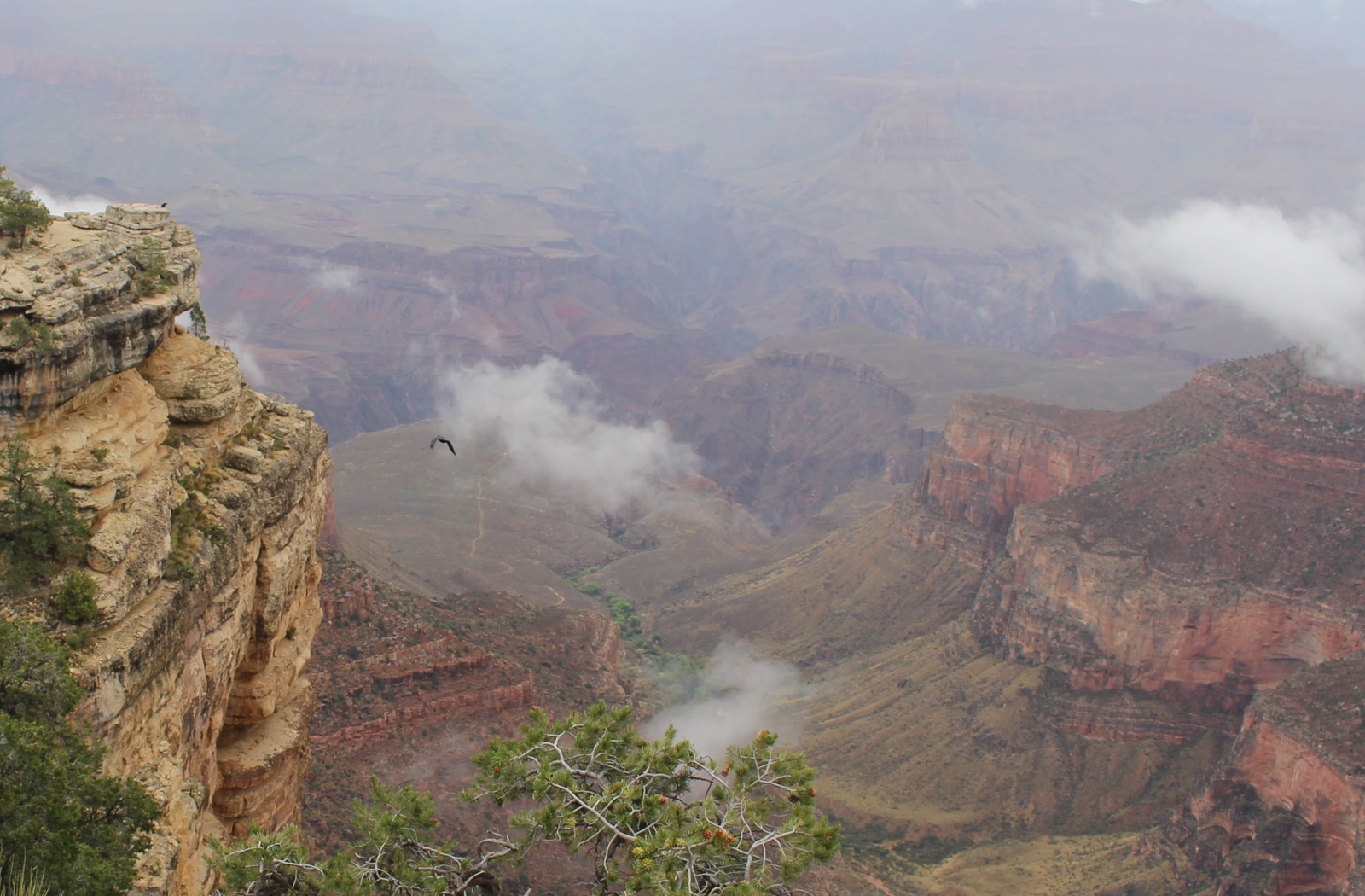
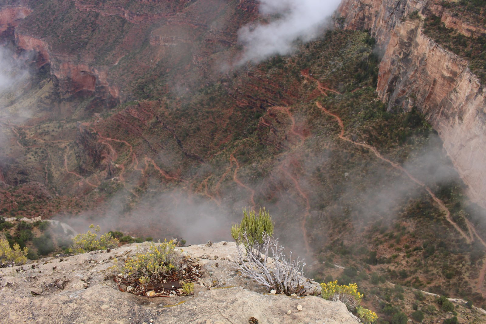
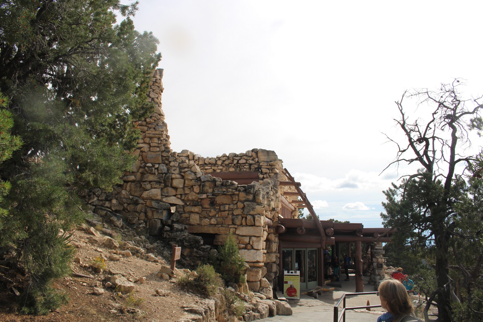
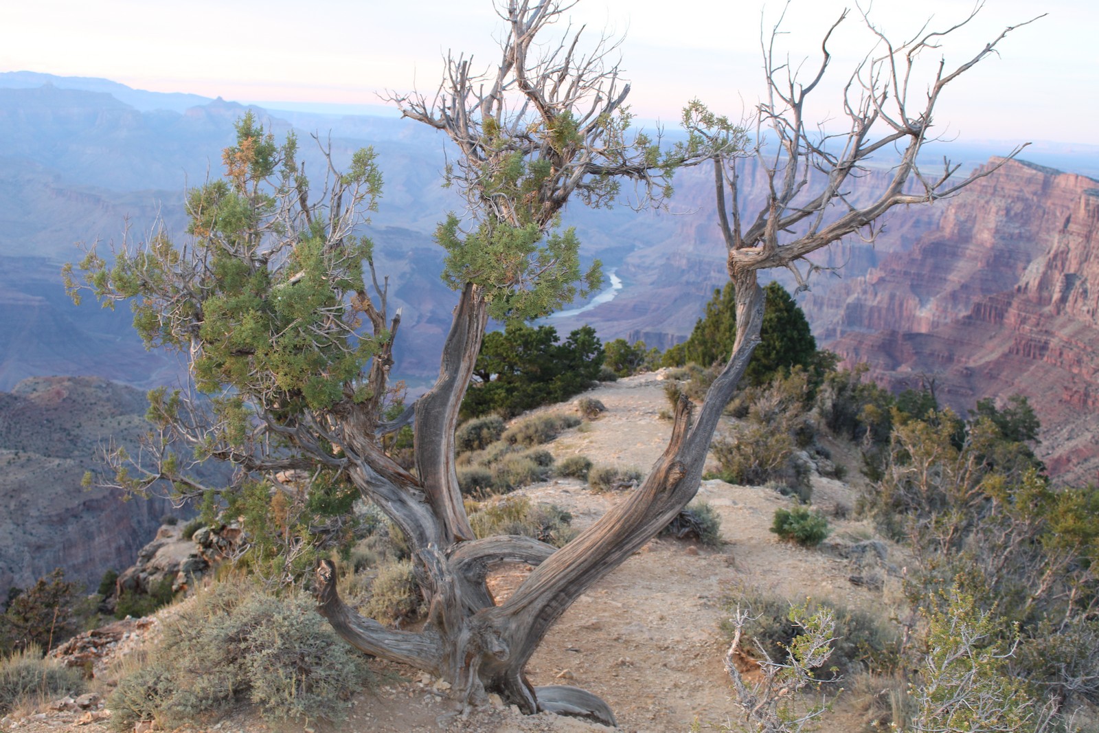
The clouds continued to break up as we walked west on the Rim Trail towards Trailview Point. Little wisps of them remained below us in the Canyon, providing dramatic background to the people on the near rim, and dramatic foreground to the far bank. They certainly provided a dramatic background to the raven in Photo 760. We could see the beginning of Bright Angel Trail that led to the Canyon floor, 4,380 feet down. (Photos 790 and 800). And we got another view of the Kolb Studio, perched on the Canyon's edge from across the valley as seen in Photo 810.
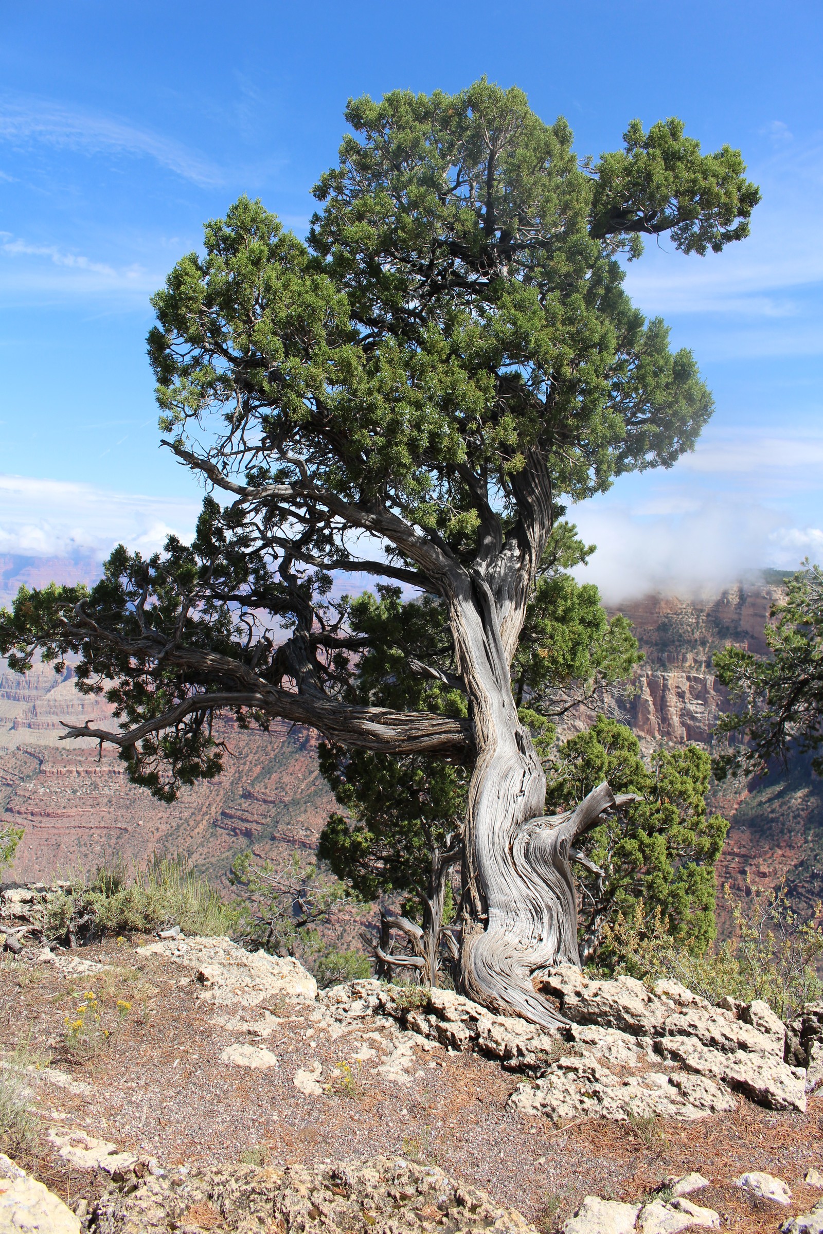
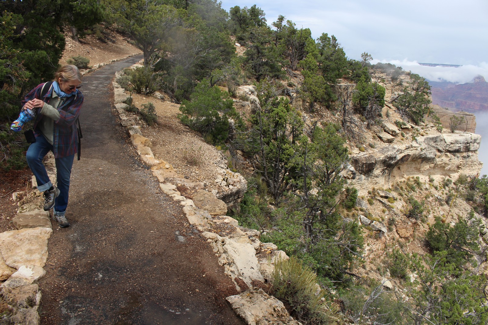
As we continued west on the Rim Trail towards Powell Point, it continued to warm up and clear up. Flannel shirts, sweaters, and umbrellas went back in the packs. Photo 840 (I have no idea what Jenny is doing in that photo.) gives a good picture of the Rim Trail: well paved, and lined with decorative stones, and sometimes right up to the edge of the rim with no guard rail. I like the idea that the Park Service trusts us well enough to believe that we are competent to walk along a four foot wide trail without falling off the edge. (Science fiction author Jerry Pournell calls such people who fail in such elementary tasks examples of "evolution in action".) I love the gnarly old tree depicted in Photo 860, like some sort of giant bonsai.
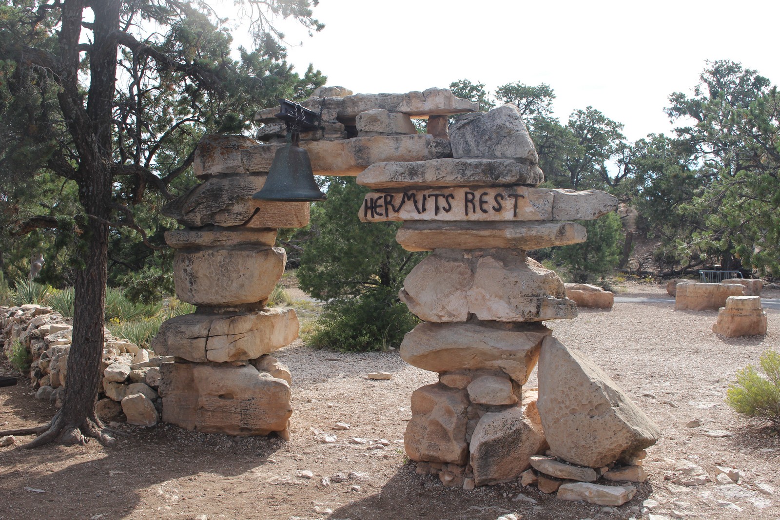
Hermit's Rest
|
|
|
|
|
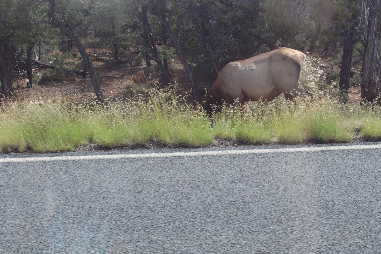
I realized simultaneously that the batteries of my camera were getting low, and that my own personal batteries were similarly sagging. But we wanted to see Hermit's Rest at the western most end of the Rim Trail. So we picked up one of the passing busses that the Parks Service provides, and took it out there. The wildlife in the area have become so accustomed to human and automotive presence in the area that it is not at all uncommon to see things like the moose in Photo 900, taken through the bus window, grazing alongside the road. Our driver expressed anger and frustration at tourists who approach and attempt to feed such animals. Inevitably, they will get spooked and attack such people, which will require that the animal be put down.
Hermit's Rest was a lovely example of the National Parks Rustic architecture with fieldstone and wood construction. I was pretty pooped and hungry, so I contented myself with getting a sandwich at the snack bar, and then just hanging out in the sun for a while. We took the bus back to Grand Canyon Village, where I went back to the car and closed my eyes for an hour or so, and left Jenny to her own devices..
Jenny reports the following:
I strolled and gazed, and watched people watching squirrels, and read about the telephone wire that was installed all the way down to the base camp below--that must have been a challenging project at the time. There was a little rain, off and on.
Sunset at the Desert View Watchtower
|
|
|
|
|
|
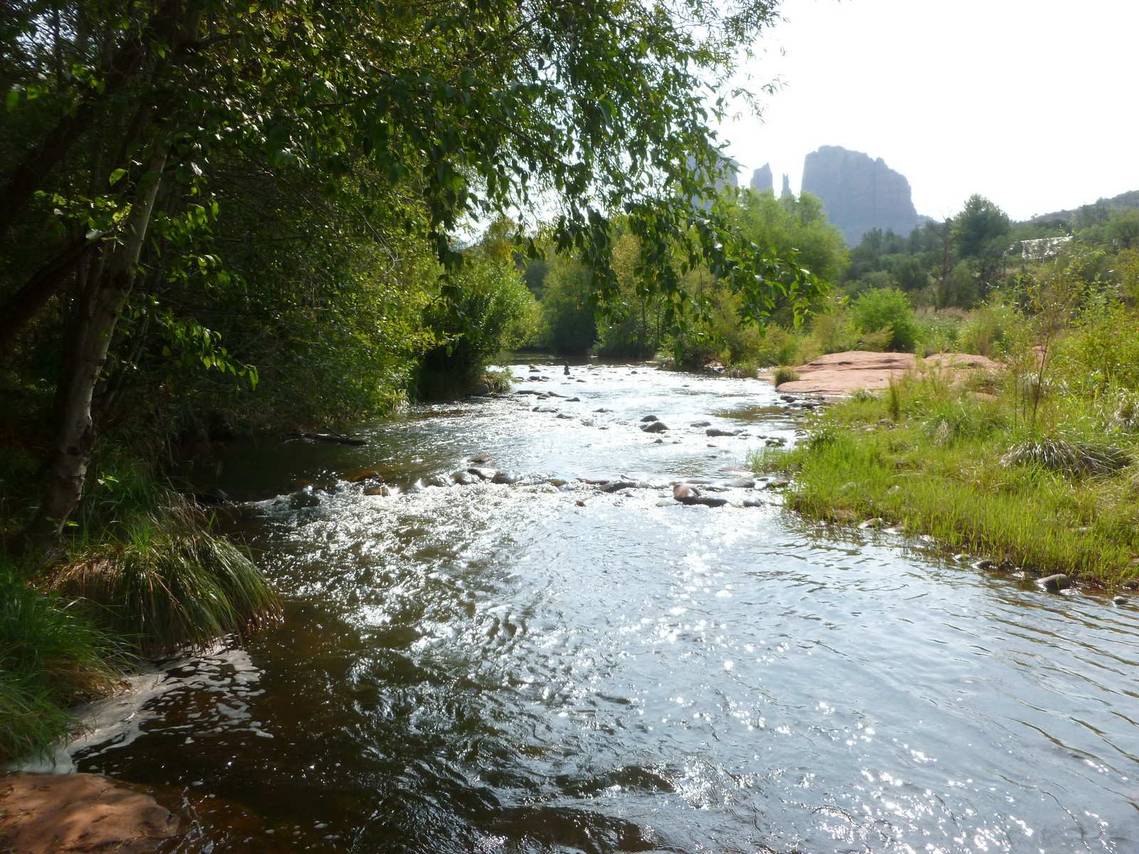
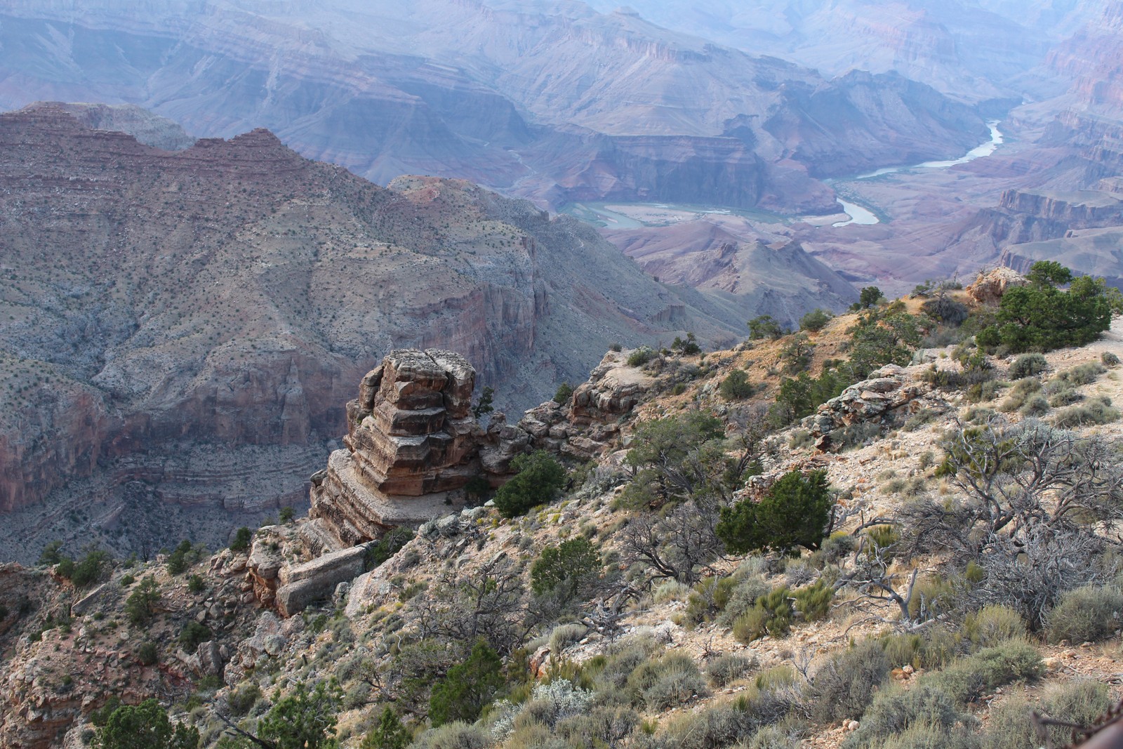
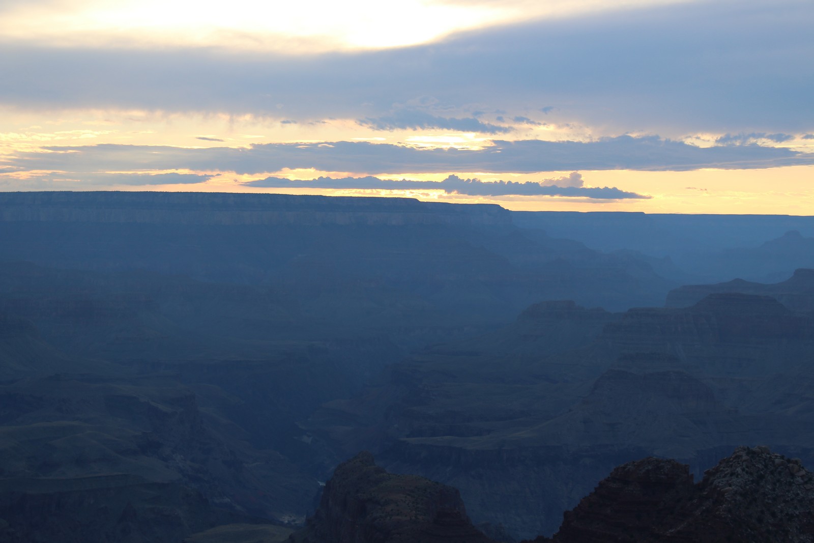
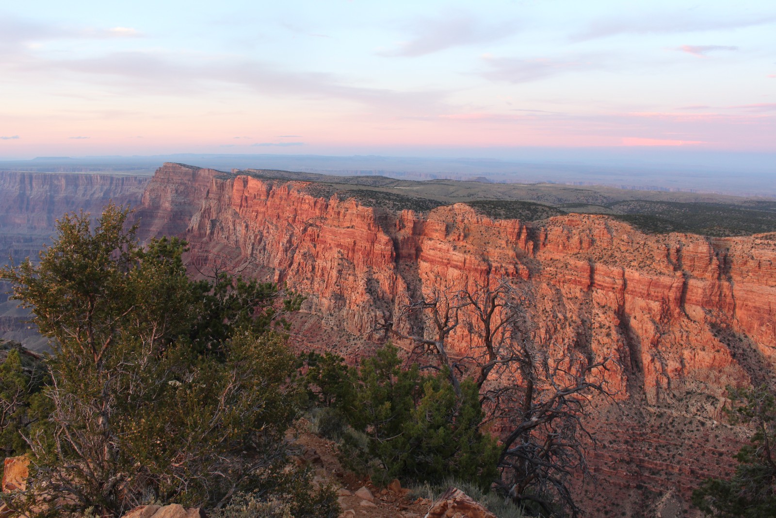
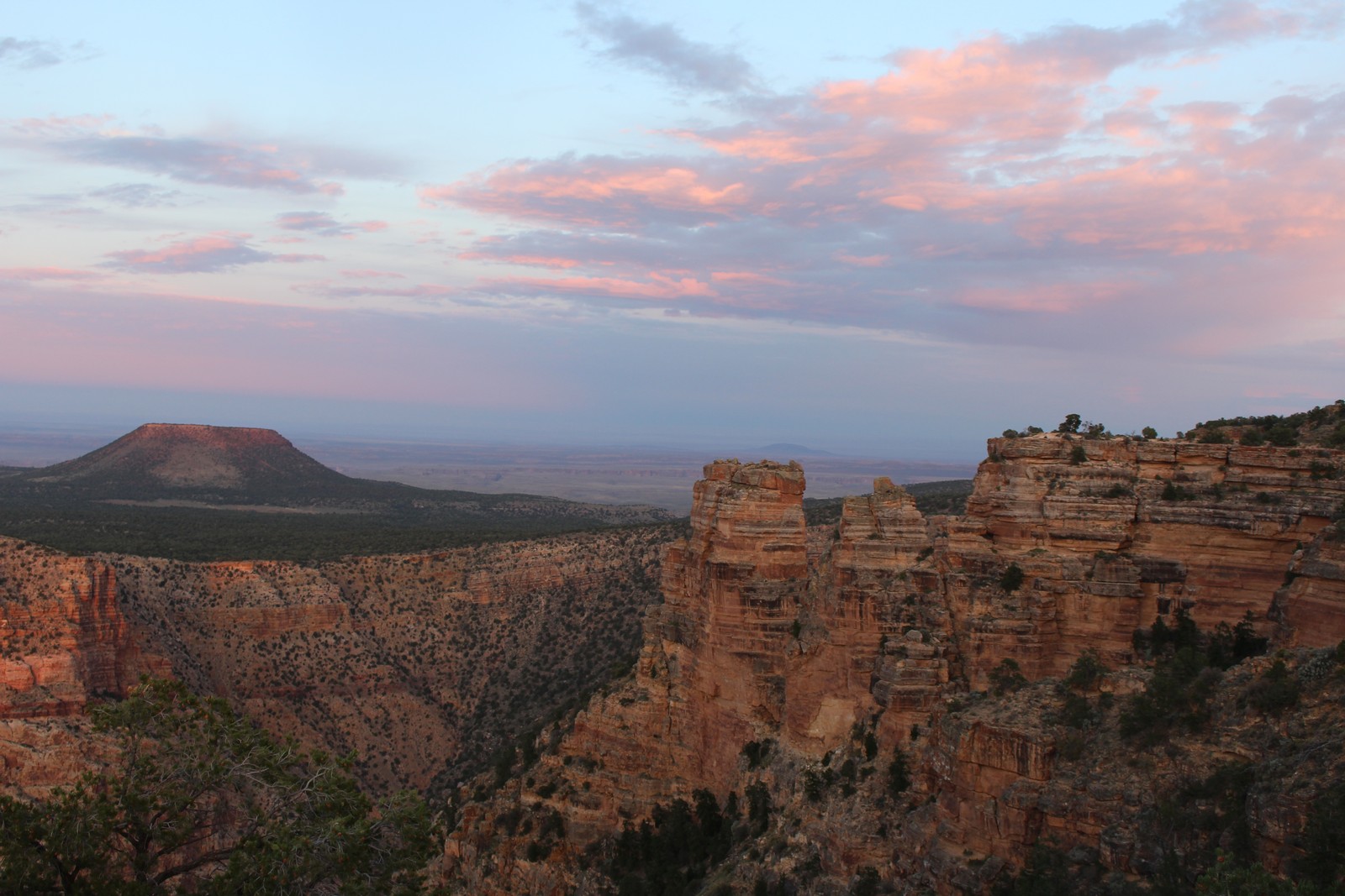
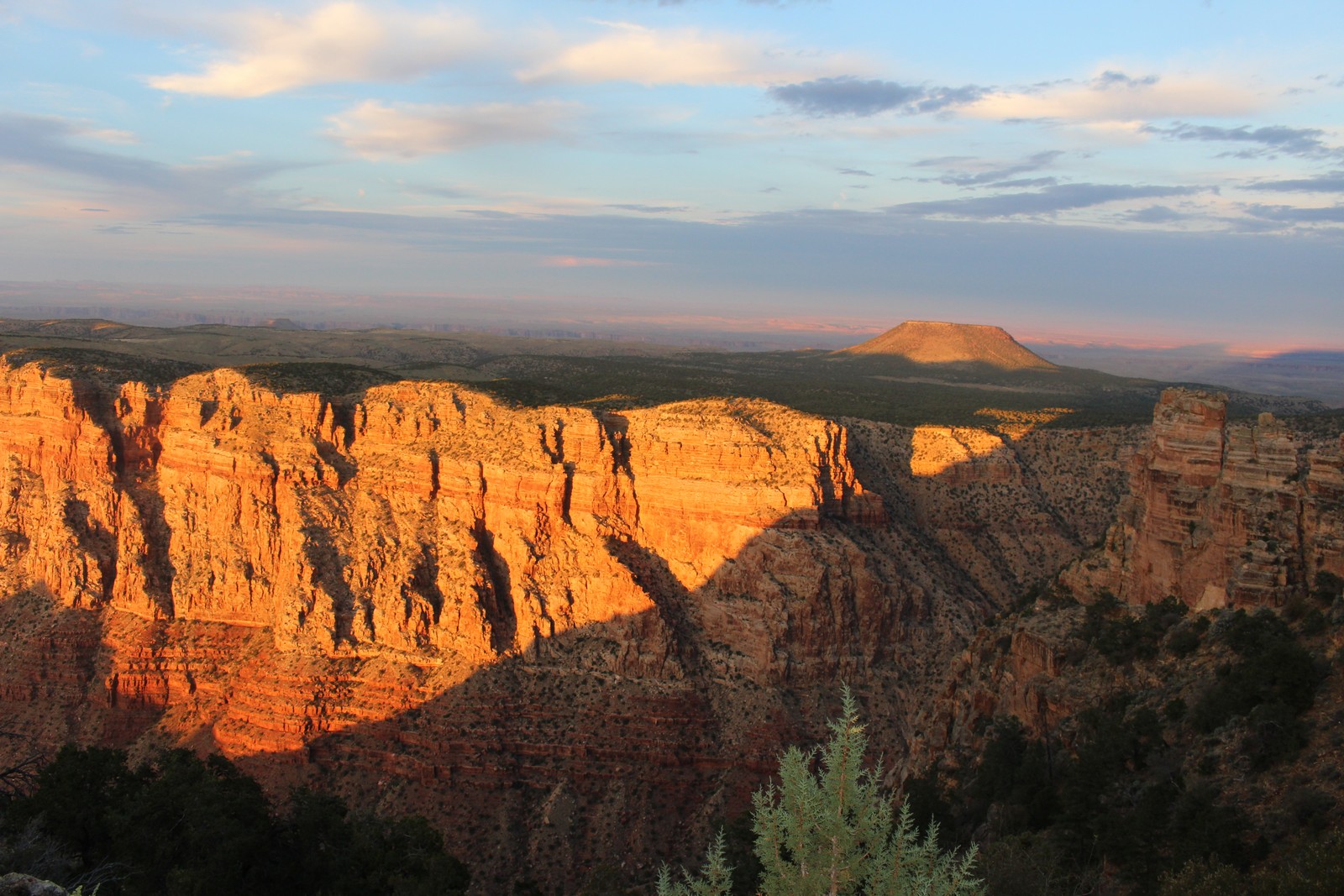
They told us you gotta see the sunset over the Canyon. And the best place is the Desert View Watchtower, where we first arrived at the Canyon the previous day. So, as the day drew to a close, we got in the car and drove to the eastern entrance of the park. We arrived just in time, as the sun was just above the horizon when we got there. I climbed down to a place from where I could get a good view both East and West. First thing I noticed was that this vantage point was the only place in our wanderings from where we had a good view of the Colorado River (Photos 960 and 965), which was what was the ultimate cause of the Grand Canyon in the first place. It was so foggy the previous day that we never saw it.
Looking West at the sunset (Photo 970) was overwhelmingly calm and majestic, but I did not have the photographic skills to capture that sensation fully. But you'll notice that there were bands of clouds on the horizon. And as the sun set, it alternately went behind a cloud band, and then popped through between bands. And the effect of that on the view to the East was dramatic. With the sun behind the cloud, the colors of rock and sky were muted and subtle (Photos 975 and 980). But when the sun peeked through, the rocks exploded in brilliant oranges and reds (Photo 985). Both were gorgeous, and the contrast was very impressive.
It was a long day. We got in the car and headed back to our digs in Flagstaff. I forgot what we did for dinner. We hit the rack and rested up for the next phase of our journey the following day.
| PREVIOUS | NEXT | HOME | BACK TO BLOG |